
MQ Patrol in the Bush were it belongs
Really another bunch of trip pictures, but they capture the MQ in its native habitat.
Now, if I could only find places in the US near where I live where I can do this!
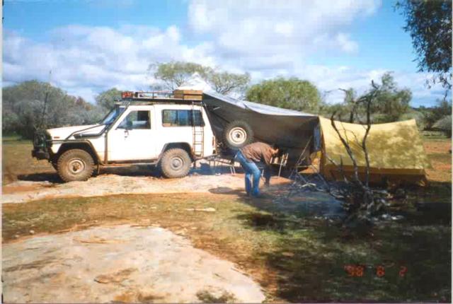
Last trip into the Kalgoorlie goldfield area was in August, mid winter in Australia and usually wet. We're driving around the edge of Pigeon Rocks and as usual near rock outcrops the surrounding area can be quite water logged and muddy. Fortunately the winch and some volunteer trees come to our rescue ;-) It's me in the picture. On this trip we took a laptop with us loaded with oziexplorer and the auslig 1:250,000 topo maps. This hooked up to my Garmin 12XL gave us real time position information on moving maps as we drove around - brilliant - didn't stop us getting bogged though ;-)
Still near Pigeon Rocks. Considering that rain was coming we figured that the best place to park a couple of tons of 4wd was on a rock. Then it was time to set up the tent, stretch a tarp out to give us some sheltered space and get a good fire going for dinner time. On the roofrack you can make out the hi-lift bolted at the front and the box at the rear has 3 jerry cans horizontally stored. 5 jerry cans can be stored in the same box on edge. Behind the hi-lift and in front of the fuel box I can bolt on a 4'x3'x1' box that gets filled up with food etc for the longer trips (to make more room inside for other useful things). The lid of the food box has a gas strut to lift and hold it up.
Heading back towards the highway via some back tracks and we visit another rock outcrop. We'd just driven along here a few minutes before in search of the 'real' track. Retracing our path back I drove about 1' or so to the right of where I had driven before and we were bogged in a matter of a few feet. This time the volunteer tree was much further away, 150' of winch cable and all the strap we had just made the distance (since this was a short trip I made the stupid mistake of not bringing the extra steel cable). Fortunate because I REALLY hate having to get out of mud bogs with the shovel and hi-lift - especially when it's raining!
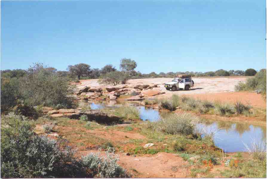
A few years back now, another trip to the Kal goldfield area. This was the winter of '96, a cyclone had dropped heaps of water in the interior that summer. We've never seen so much water in the goldfields - a REALLY nice change of pace.
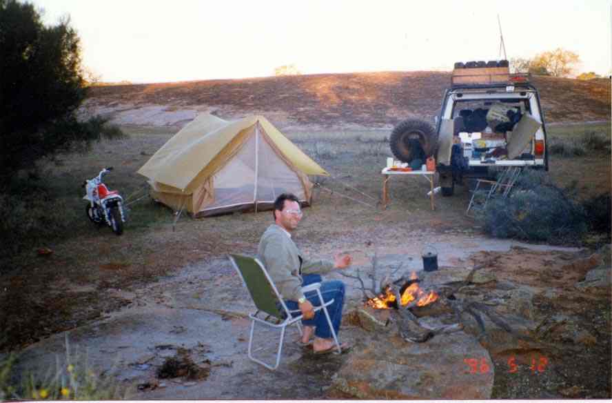
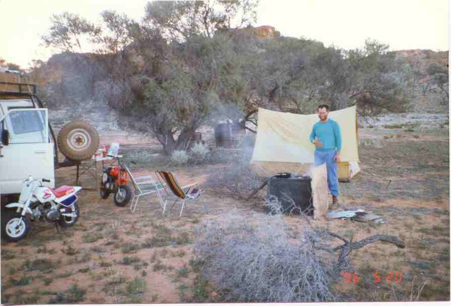
The following picture is at the back of the rock outcrop at Ullumbay Soak (30°48'52"S, 119°58'43"E). A typical camp setup. Note you can see one of the two Honda Z50 minibikes we always take with us on trips, brilliant machines. They get around 60 mpg (tankful), sit nicely on 20-30mph and beat walking. Yes, we actually fit two of them side by side at the rear of the SWB patrol! Trust me, we have packing down to a fine art!
On the back of the roof rack you can see the 5 Jerry cans on edge (horizontally with the opener at the top rear), 4 with diesel and one with petrol for the minibikes. With the 4 Jerrys and the long range tank we have around 1800km (1100 miles) range. With all 5 full of diesel we can stretch to 2000km - quite nice!
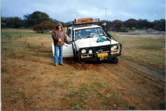
The mug is my best (male) mate - known him since we were about 5 yrs old - he's my camping mate and equally 4wd crazy (if not more so)!
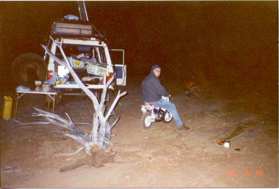
It's winter and cold (well for w.australia anyway), and it's time to collect firewood. Z50s can even tow - took both of them, but we did it. You can see the foodbox lid up (on top of the rack), and the 5 jerry cans (4 diesel, 1 super for the bikes) at the back of the roof rack. The food box has aluminium right angle all around to further strengthen and protect the corners of the plywood box. A nice thing of having the foodbox at the top of the vehicle is that locating food and cooking gear is really easy, it's all laid out in front of you and leaves the interior of the vehicle free for lots of heavy stuff including the Z50s. This spot is at Johnson Rocks (29°48'17"S, 119°49'21"E) - a nice area with a great gnamma hole full of water.
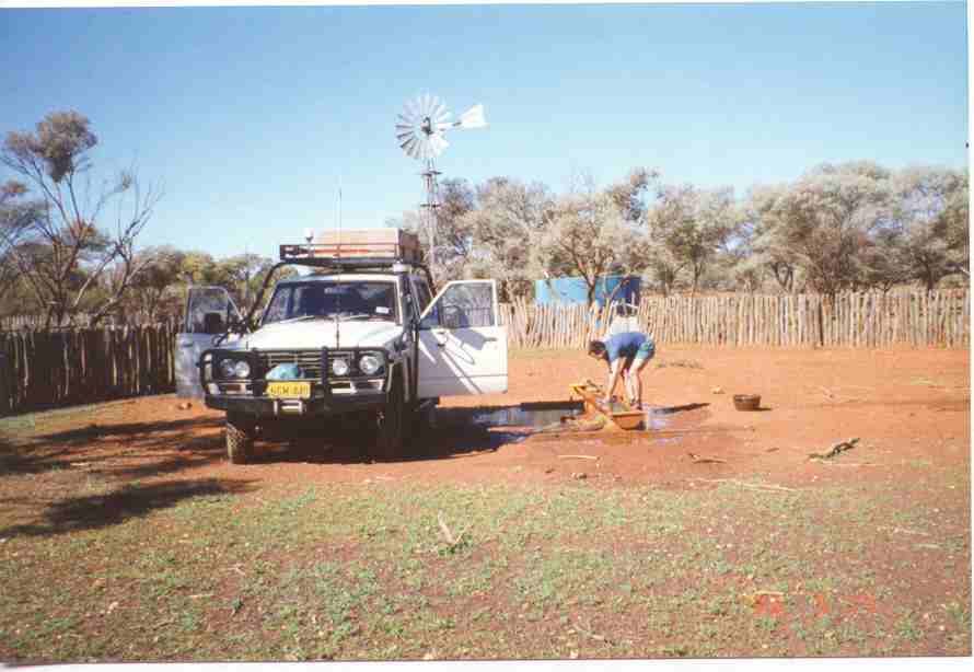
Dairy Corner Well (29°15'59"S, 121°33'04"E), just a typical station well. Handy place to wash up dishes etc. We usually clean out the trough for the cocky while we're at it - small payment for use of the water... The white acorn like thing on the front left of the roofrack is the GPS antenna for my old magellan 5000 GPS. I now use a Garmin 12XL and a miniature external antenna that I just stick to the top of the above dash mounted CB radio - works great.
Like I said, lots of water in the goldfields, this is about 5 months after the cyclone went through - creeks with water in them - bloody amazing!!
Just another camp site on a remote dead end track. The remains of some previous prospecting attempt are in the background. We used a rusted out old water container (the big box thing) as our stove. As usual when camping out - appetites are always at the ready. (near 29°06'41"S, 121°55'40"E).
![]()