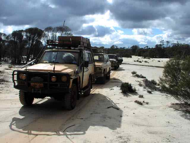
- Myself "Grumpy old man" (Keeper of the holy path - i.e. in charge of keeping us from getting totally lost).
- Lionel "just like new" "$50 tyres - a baaargain"
- Richard "we are running out of water" "the kettle must whistle to be at the right temperature for the tea" (Mr Gourmet food)
- Kim "I think I took that a little too fast" "I went up on 2 wheels" (cruisers can cross any obstacle in 2wd - not)
- Barry "yes dad'' (son of Lionel)
- Tim aka Tigger "what?" (son of Richard)
- Jennifer "I'll eat that" "I'm hungry" (daughter of Lionel and harboring a tapeworm)
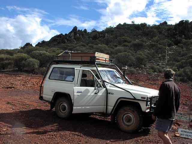
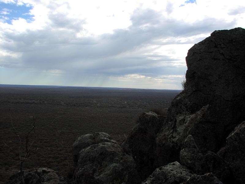
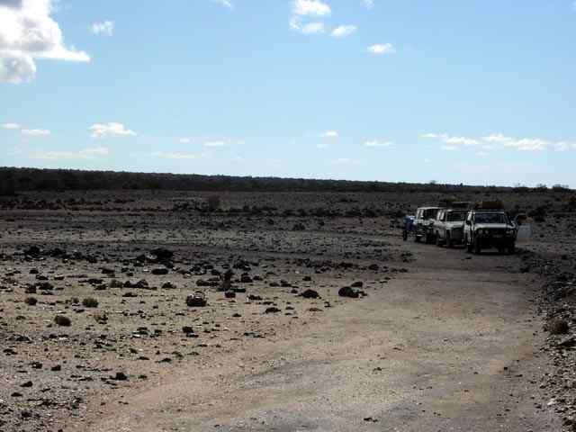
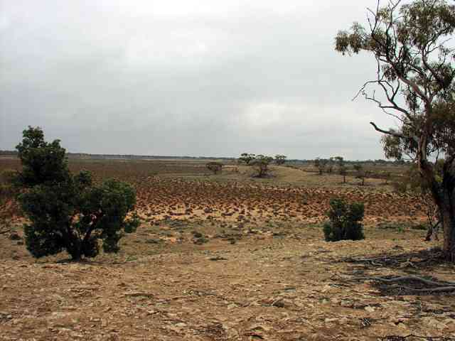
The picture shows us as close to the pinnacles as we could get on the Windarling Range. It's an iron deposit that has attracted the attention of mining companies but as of this instant they do not have permission to mine - yet... Presumably if they get the go ahead, this entire range will be gone. Not sure why they need to mine it - it's not as if there is a shortage of iron ore from other established mines in W.A. - guess it's the typical greed of mining companies - "nothing's as precious as a hole in the ground"...
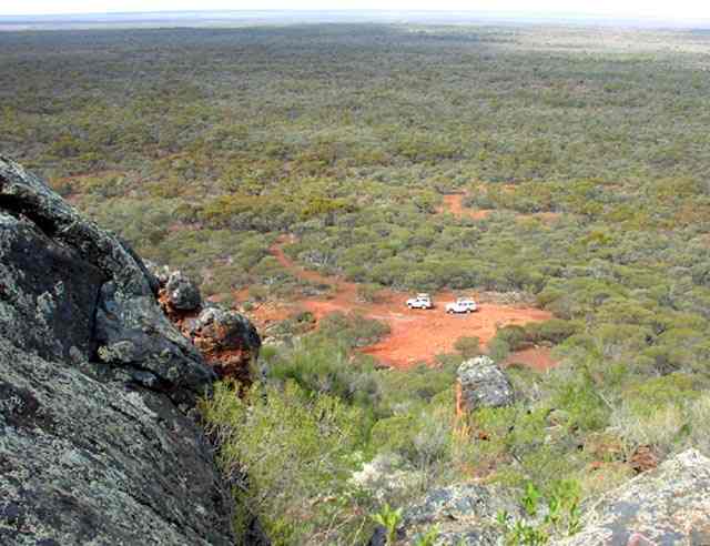
This is the view looking south - considering how flat the surrounding area is, you can see a loooong way. We found a few rock holes with water from the recent rains.
Updated 2012:
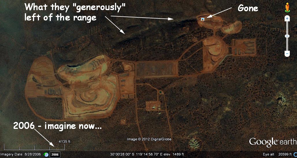
Check out this report http://epa.wa.gov.au/EPADocLib/2500_B1256.pdf and specifically page 38 to see what our wonderful Mining industry has done to this area. Here's a picture (very close to the same spot as the above picture) and the report's own words (2007 report, so imagine how much more "devastated" this area is now...). You can visit Google Earth to see the most recent damage that has been done and they haven't finished yet!:
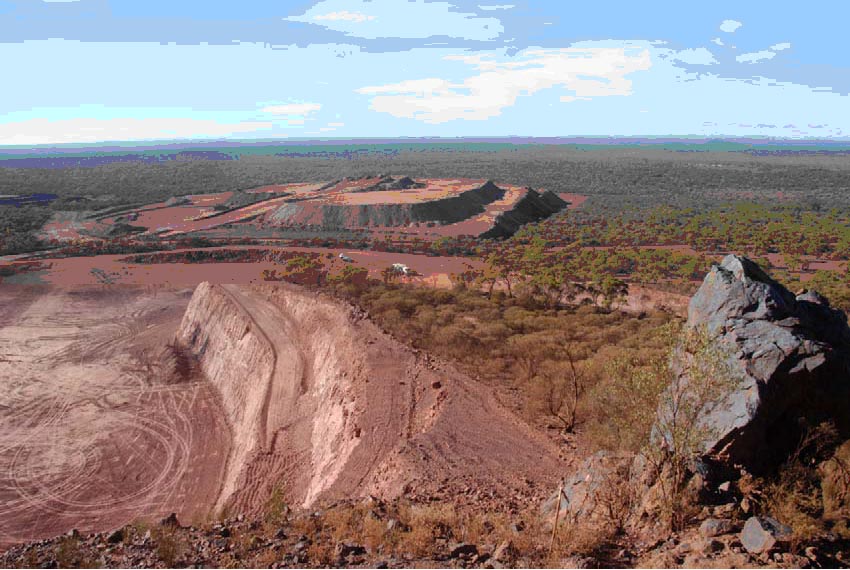
Figure 10: Mining at Windarling Range has resulted in substantial permanent alteration of landforms and loss of habitat for rare species
I had put several picture of this area up on Panaramio and received a comment from someone via Google Earth/Panaramio stating that I was being political in calling this "mining devastation" and this person claimed that very little damage had been done to the area (this person worked at Windarling...). Yeah, right - what the heck would that person call "major damage"??
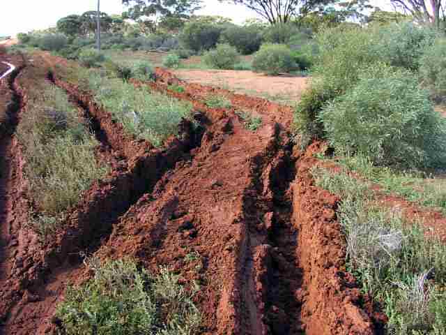
Just to bring the point home, the following picture is a spot that no longer exists on the Windarling range - it has been blasted/scraped away and shipped off to China. I have a GPS fix of this spot and on Google Earth it is now just part of the mine area. Of course this is another fly in/fly out mine with a haul road. So, no useful infrastructure built for the future, once they've finished with the mine they'll just move to another place to make another big hole. I'll BET they don't fill the hole or make ANY attempt to re-vegetate the area, just like all the other open cuts in the gold fields. The greed of companies and the government at work again...
And the final proof of how much damage has been done - NOTE, this is 2006 Imagery data - imagine now in 2012!!!
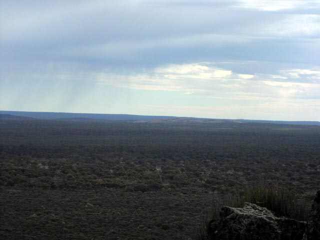
The view to the North, you can see Pigeon Rocks just to the right of the middle of the picture. From Pigeon Rocks you can see the Windarling Range - it looks a little like the back of a stegasaurus, because of the pinnacle structures on its ridgeline.
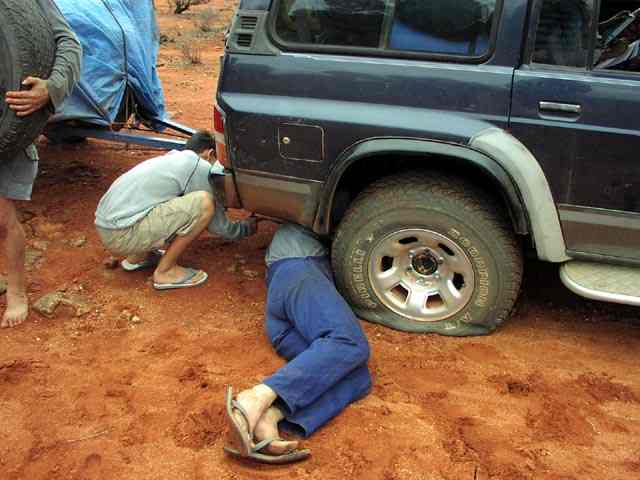
A few days later, heading north east of Kookynie on some back roads, the first flat of the trip (a few days later the same tyre gets another flat). So much for Pirelli Scorpions (they're "a bit weak") - very soft sidewalls and the center tread isn't much better. But hey - the tyres were cheap, right Lionel? And a 15" tube fits a 275x70r16 just right... Barry is helping Lionel get a jack in position to replace the tyre. Richard appears to be hugging the spare in an attempt to make it more puncture resistant ;-)
In the Yundamindera area - we're near Camel Back dam - kind of like being on the moon. No recent marks on the track.
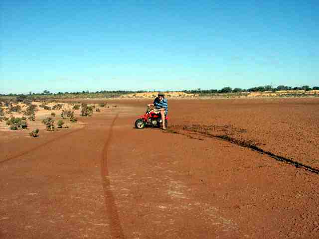
While camped at Moon Rock most of us went on minibike adventures. A shot of me venturing too far off the edge of the salt lake - one instant driving straight, the next 90 degrees. Fortunately I was in full control during the entire maneuver ;-) You can see how deceptive a salt lake or clay pan can be - Lionel's minibike tracks are to the left of where I rode.
Heading up the northern west side of Lake Minigwal. Stopping to take a picture - no recent marks on the tracks, we're in fairly remote areas now. A light drizzle is falling, enough to stop the track from being dusty but not enough to make it a mudfest.
Just because I stopped for a picture doesn't mean it's time for another flat tyre! Left to right, Richard, Tim, Lionel & Jennifer inspect a rather flat (only on the bottom) tyre. You already know what 'great' tyres the Scorpions are - definitely $50 worth... Our original repair was fine, another stake on the edge of the main tread area caused this flat.
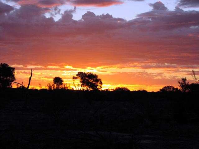
Surprise Granites, near Lake Minigwal (on its eastern side). What a rotten sunset ;-) We had some showers overnight and the rocks had lots of puddles of nice clean water - just perfect to wash pots & plates etc.
One of the many small ephemeral lakes that make up the Lake Minigwal system. Not sure what the troops are looking for - no fish out there. Some of the lakes are muddy and some are sandy, this one is sandy.
The convoy on the southern edge of Lake Minigwal. The lake is surrounded my many mounds that appear to be rocky but on closer examination are made up a material that is quite brittle and the ground is somewhat spongy - very strange sensation walking on it. I doubt it would support the weight of a vehicle.
Same place as above, but looking into the chain of lakes that make up Lake Minigwal. Yep, heaps of water... More like claypans and salt bush than your typical salt lake.
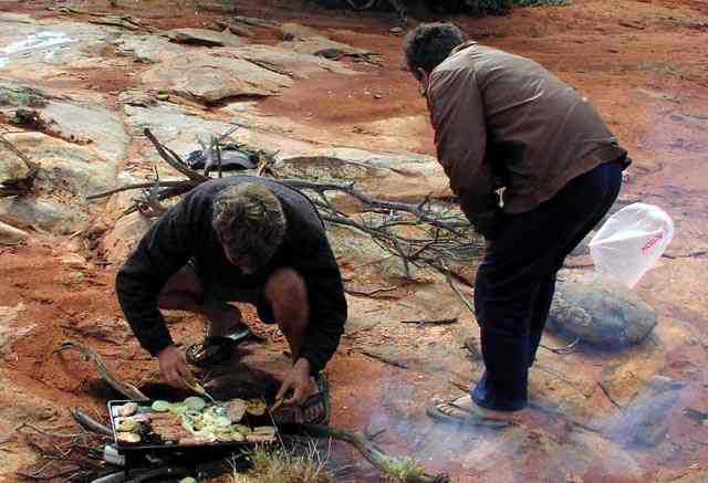
On the southern middle area of Lake Minigwal, lunchtime!! We had quite the elaborate meals on this trip - we all brought more than enough food so we never had to resort to baked beans or other 'emergency only' food. Richard is demonstrating the fine art of bbqing, not sure what Lionel is doing...
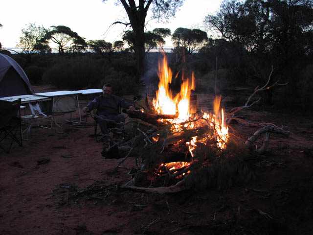
Just south of Ponton Creek, Kim must be a little cold. I'm sure once the fire kicks in he'll be moving further back...
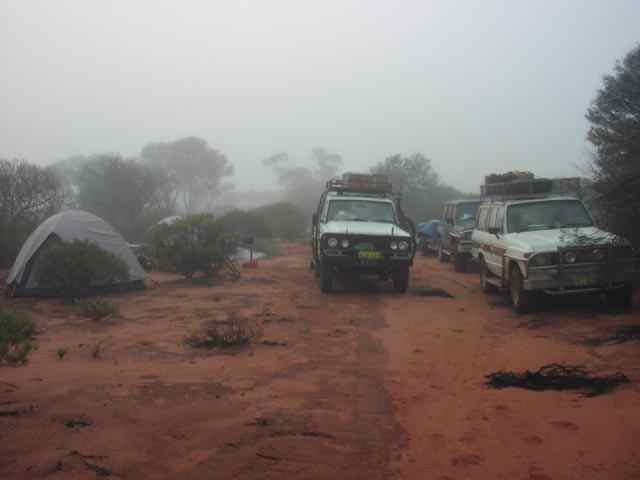
Same campsite as above near Ponton Creek, it's morning and very foggy. The one and only day/place that we had fog, made the whole area quite spooky. Note we're camped/parked on the track ;-) You can tell that this track doesn't see many visitors... Walking a few hundred metres allowed the vehicles to disappear - easy to get lost on a walk to the potty ;-)
Lake Rebecca - the old road. We decided to take a 'short cut' and use the old road instead of the new one that goes around the lake. Well, it was a shortcut only in distance ;-) On first appearances the lake appeared way too wet and muddy when we walked onto it. But since I was in front and already had my tyres on the edge and needing to turn around I reversed around. While reversing I figured, what the heck (especially when Lionel mentioned something about me being too scared to try going in) and kept reversing to see if it was actually hard enough to get onto - with the plan that I could winch myself back out if necessary. Anyhow, I successfully got across the first bit onto slightly higher ground. After that the others came over to where I was too and we started our great lake crossing adventure. I went ahead a stretch at a time (heading forward this time!) and then the others would follow. We did this for 5.5km - quite the adrenaline rush, especially since it had been raining the last few days and a local had told us the main road was quite boggy in places... Sometimes we would get out and check the firmness of the ground under the mud with a shovel - better safe than bogged to the axles on a salt lake ;-)
The bright red is a track log from the GPS and Oziexplorer showing the path we took across the lake. We diverged from the 'road' since we decided to stick to what appeared to be the harder surface - that and the 'road' was pretty well invisible, we were definitely the first vehicle to cross the lake in many years, though lots had driven down to the lake edge and then turned around. When we got to the west side of the lake it started getting quite boggy, 4wd LO, diffs locked and mud flying everywhere ;-)
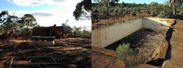
We camped just south west of Old Pinjin at what must have been a very impressive homestead in its time - mud brick contruction, plastered on the inside and even tuckpointed! It even had a swimming pool! We camped 2 nights there and the following picture shows the remains of the house and the pool.
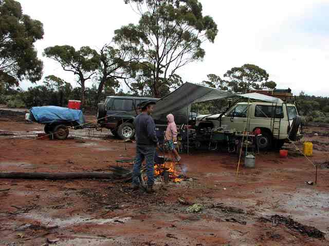
Same spot as above on the morning that we were breaking camp. A few showers overnight left wet puddles all around camp and made for a muddy road out. The rest of us had wet weather gear - Kim felt his hat provided all the shelter that he needed.
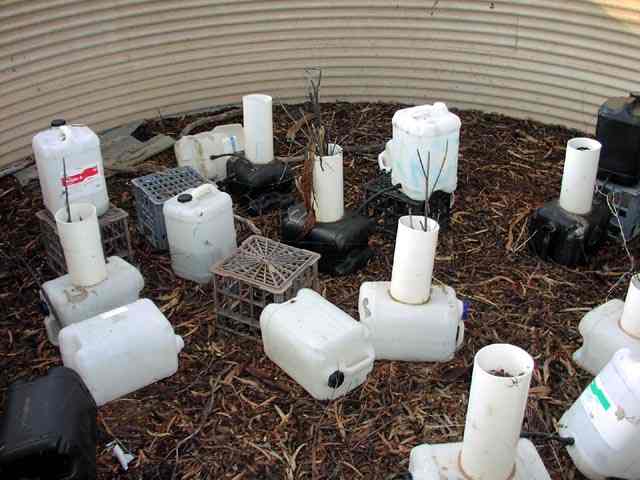
When camped we looked into one of the large tanks and this is what we found. I'll leave it to the reader's imagination to figure out what had probably been grown here...
Good a time as any to repair the #2 flat tyre of Lionel's. I think I've made a Tyreplier sale here ;-) Talk about all the conveniences - even a set of nicely placed concrete slabs! Richard & Kim look on as Lionel works on flat #2.
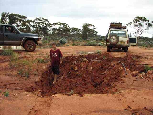
Just about to hit the transline north east of Coolgardie - one of my many shortcuts. Tim's affinity for mud is obvious here as he rushes to stand in the newly turned soil. The others decided not to tread in the footsteps of my front/rear locked swb nissan. You can imagine from the photo what a nice pickle the nissan was in for a minute or so - got out on its own steam though. This was to set the stage for the next part of the trip ;-) You can see behind the blue nissan the pools of water on the side of the track - definitely soggy ground abounds.
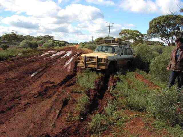
Ah, Kim in his cruiser - not so lucky - even speed couldn't stop him from getting bogged this time. You can barely make out the synthetic winch line pulling Kim out. The tracks in front of Kim's cruiser are from Lionel's patrol - that also needed to be winched out. What nobody else noticed (I was last in the convoy at this obstacle) was that there was a perfectly dry and hard bypass on the left side of the picture near the train track which I took to get around to winch them out... Gotta love a 24V 8274 winch! Single line pull.
Hmm, I think he was nicely bogged - lovely gooey mud! So bogged that his cruiser actually got dragged along its belly on the mud.
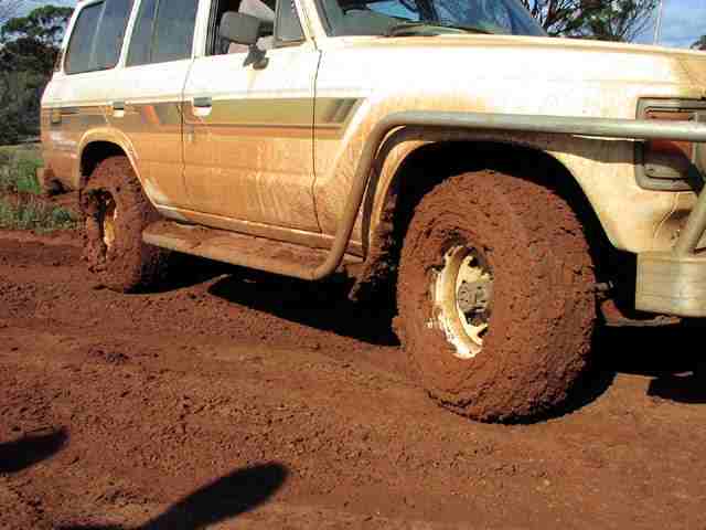
Yep - dragged! The tracks on the left are from Lionel's nissan being winched out and the ones on the right are from Kim's cruiser being winched/dragged out. I think the lesson that they learnt was it's usually better to drive through the center of the track where the water is than around the edge where the water has fully saturated the surrounding uncompacted soil... (but that's just my theory)
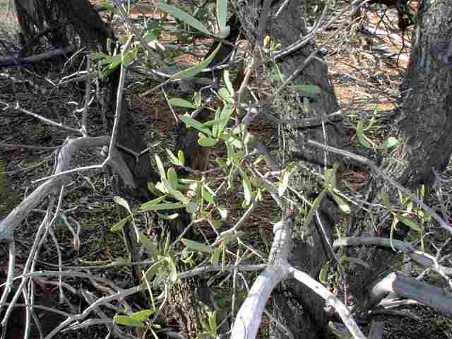
A close up of a Sandalwood tree and it's leaves. Only the old dead wood has the characteristic sandalwood smell. The leaves look very much like the quandong tree (its close relative). Both are parasites that need an appropriate host tree's root nearby to tap into.
Just south of Weowanie Rocks - a small river running between two salt lakes. The ground was sandy and rock hard as witnessed by the tyre tracks. Lionel's nissan patrol is the last in our convoy going across.
Same place, different view. Basically the end of our trip, a couple of k's further on we hit a good graded road at Duladgin Rock and followed that south to Yellowdine, from where it was a ride back on bitumen to Perth. This is when Lionel decided his guage was still showing 1/4 tank and he was complaining that I should fill up further down the road rather than at Yellowdine (my tank holds 160 litres). Guess what, about 60km later (after having passed Southern Cross) his tank ran empty - and the guage still showed 1/4 full ;-) Lucky for him Kim still had about 15litres of fuel in a container and we were able to put enough fuel into his tank to get to the next fuel station. The story then comes out that he's never run the tank lower than 1/4 on the guage - the nissan is new to him - he also discovered the 'long' range tank is only 120 litres... I had taken 40 litres of extra diesel for myself (on the roof) and 40 litres for him - but we'd already transferred that fuel to our respective main tanks by this point in the trip.