11 day trip to the Diemals/Barlee area
Another trip to the bush all over, total distance about 1600km.
The basic trip was from Perth to Bullfinch and then to Pigeon Rocks. From there we went across to Johnson Rocks via the Manning Range. Then around the east side of Lake Giles and on to Mt Elvire station. Back down again and to Diemals and then up towards Barlee Station. Some back roads to Malgar Rock and then east to the rabbit proof fence. Down the fence and popped in to see Earoo Rock and then back down the fence and to Muckinbudin and back to Perth.
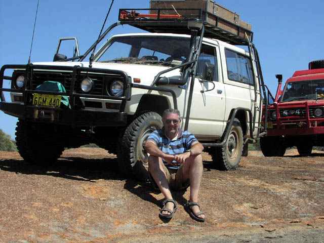
Following are some of the pictures from our trip. The participants were:
- Myself (Keeper of the holy path - i.e. in charge of keeping us from getting totally lost).
- Lionel "just like new" "$35 tyres - a baaargain"
- Richard "the kettle must whistle to be at the right temperature for the tea" (Mr Gourmet food)
- Rod "No more flat tyres!"
- Barry (son of Lionel)
- Jennifer (daughter of Lionel and still harboring a tapeworm)
- Tim (son of Richard)
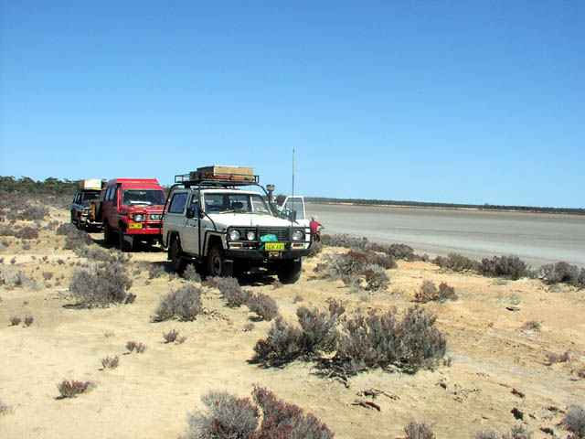
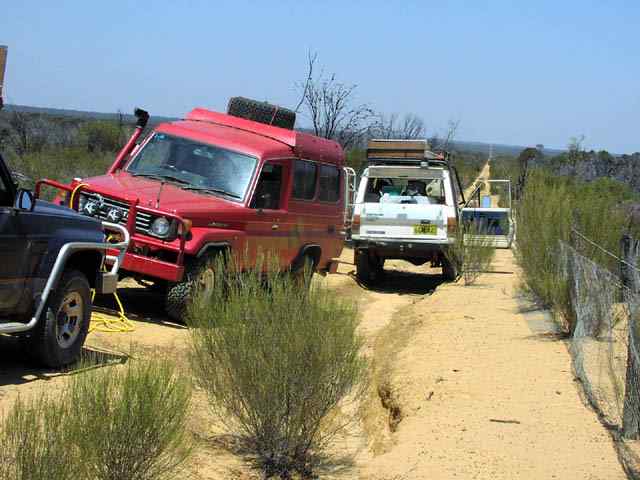
Pigeon Rock camp. This was to set the stage for Rod & Lionels tyre adventures. Rod took honours with 5 flats with Lionel a close runner up with 4 flats on this trip. Rod's aircon based compressor was definitely put to the test.
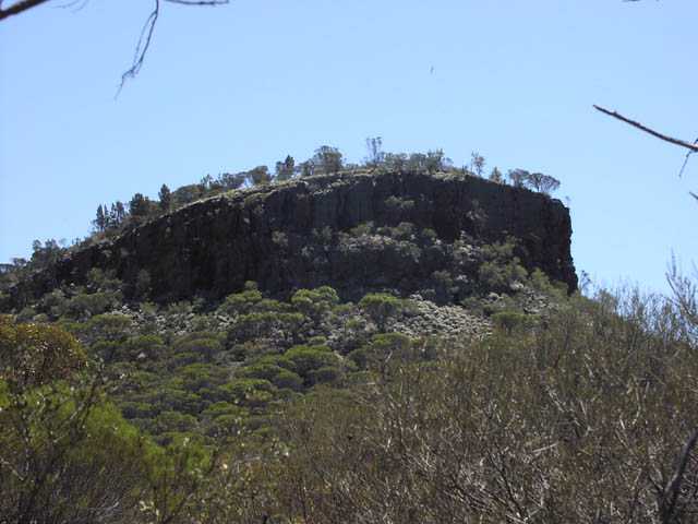
Faye's bluff in the Die Hardy Range. Quite an impressive sight and a great view from the top. You can see Pigeon rock to the west and the Windarling Range (which is being defaced by an iron ore mining company) to the south west from the top of the bluff.
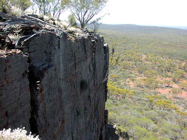
At the top of Faye's bluff - a picture showing the sheer walls on the southern side that give the bluff its appearance. Rod took us to Faye bluff, having visited it in the past.
Lionel trying to get ahead of Rod on the flat tyre competition - he got 2 in one go. Later Rod grabbed the lead again by scoring 3 flats in just a couple of minutes.
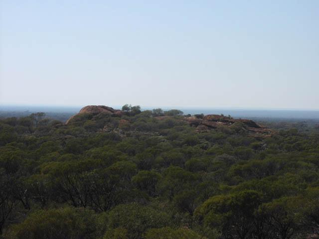
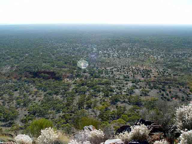
This was the camp that we chose when we ran out of daytime to locate the track to the Mt Manning Meteorite find. Using this as a base camp - nice spot near an interesting outcrop - we headed out the next day and found the track. This pic is by Rod when he got up early and climbed to the top of the Mt Manning Range. The 'brightened' up a circle where our vehicles are parked - you can see that there's not many folk camped near us ;-)
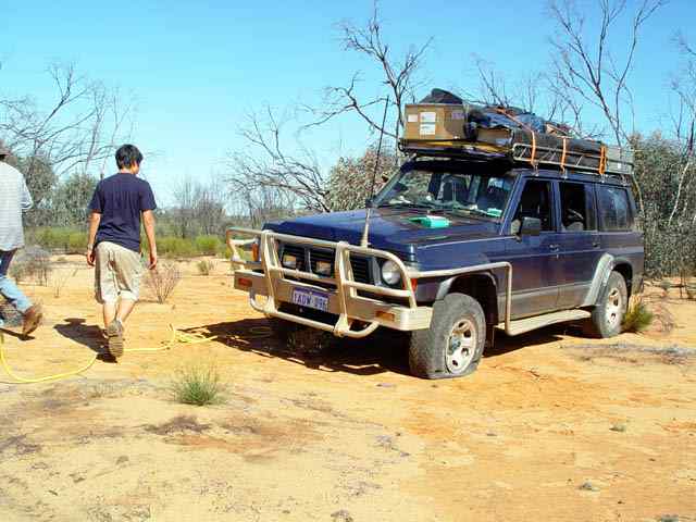
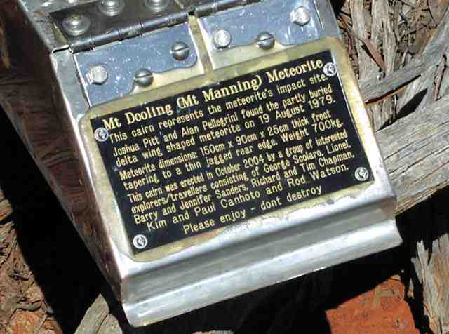
Rod had got this box made up to locate at the site (as close as we could determine it to be) of the Mt Manning Meteorite. The track (shot line) to the meteorite site hadn't seen a vehicle for many years. Kim & Paul didn't make it on this trip, the inscription was made before they cancelled on the trip. Rod scored 3 flats coming out of the track to the meteorite site. I scored one on the minibike I was using as the 'leader'.
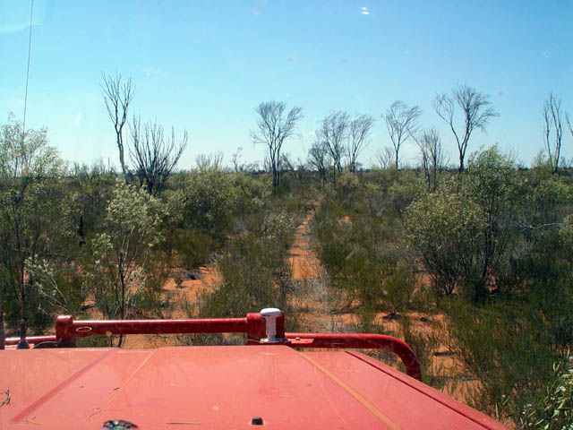
Starting our drive around the eastern edge of Lake Giles after leaving from Johnson Rocks where we had camped the night before. Another very unused track that put the GPS and moving map software to a good test. A stretch of about 4km of track was pretty well gone and we just drove where the GPS and map showed the track should have been. More than a few times it required searching on foot for the best path to take. A great adventure to find our way to the Mt Elvire road. We took most of the day to get from Johnson Rocks to Mt Elvire Homestead (not a shortcut)... At this stop Rod scored another flat and we changed out to a spare.
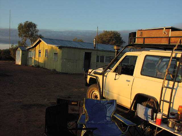
Sunrise at Mt Elvire Homestead (a CALM reserve now). A great place to have a warm shower once the heater system is stoked up - wonderful!
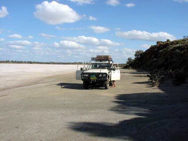
We found an old set of tyre marks a bit north east of the homestead heading along the edge of the lake. This gave us the incentive to follow them for about 12km or so along the western edge of the eastern arm of Lake Barlee. Rod got to do some salt lake driving (which he earlier seemed less than eager to attempt). By staying within close proximity of the lake edge we had a relatively hard surface to follow and 2wd high range was more than adequate. I attempted a few departures from the lake edge and did get to spin a bit of mud off the tyres before quickly retreating to the lake edge again.
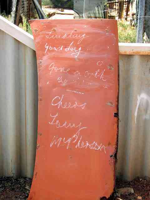
The sign greeting us at Diemals. Fortunately Tony (the station owner) had just returned from his run to 26 mile bore (repair) so we had tea with him and chatted for a few hours. If you're ever up that way, feel free to drop in on him - he's a great guy and will talk your ear off (though he did concede defeat to Lionel)...
A picture of the Diemals Homestead from the front. It's only about 1km from the main Trainer Rock Road and is well worth your time to drop in on.
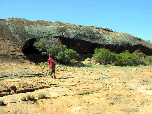
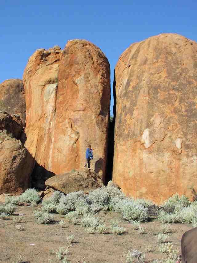
Malgar Rock. The picture shows a small cave structure that contains a reasonable amount of Aboriginal art. Bats also call this home. Malgar Rock is on Barlee Station. We met the station owners and they appreciate a call or a drop in to tell them you're in the area & driving around on the station tracks. To get here we took an old and quite overgrown track (don't do it if you're worried about brush constantly rubbing on the sides) north from Quartz Bore then west along breakaways and small outcrops (quite scenic). Over the rock outcrops the track can be hard to find/follow. On the worst of them, the station owners have built small rock cairns (we added a few more) to mark where the track goes. Lionel & I had been on this track about 20 years ago and it was a little but not that much better than this time.
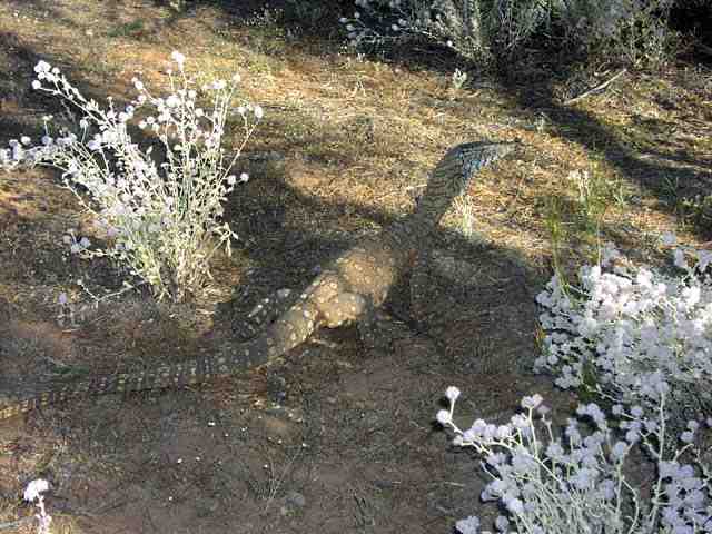
About 1.2 metres long and looking for lunch around Malgar Rock. The perentie, Varanus giganteus, is Australia's largest species of lizard. They are quite the predator and we saw several on this trip.
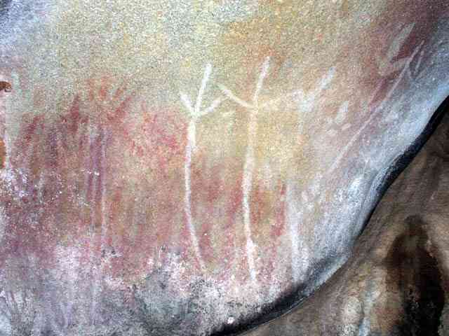
Some of the Aboriginal art inside the cave at Malgar Rock. There are some paintings (mainly hands) and some engravings (emus).
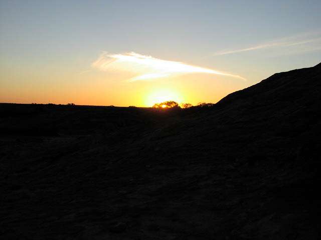
Sunset at Malgar rock. Another perfect day comes to its conclusion.
On a rock outcrop a few k's south of Toms Rock, on the way west to the rabbit proof fence. Most of the track has been somewhat recently bulldozed and is easy to follow. The last section is a bit overgrown but still easy enough to navigate through.
Rod's view of the track just before hitting the rabbit proof fence. Somewhat overgrown but still easy to follow and a recent fire had cleared all the high growth.
The back of Earoo Rock. We called this home for our last night's camp prior to heading back to Perth. The tracks to and around Earoo from the rabbit proof fence are rather overgrown - not a good place for an overwidth 4wd. Earoo Rock was the place Lionel got another flat tyre.
Morning and a view of Earoo Rock from an unnamed rock outcrop about 1km to the west.
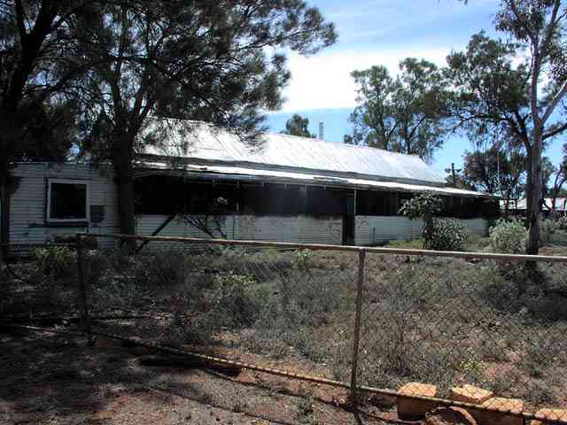
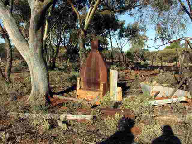
The remains of an old building near Earoo Well a couple of k's south of Earoo Rock. The well has a collapsed wind mill and contains water at quite a depth.
Heading south along the rabbit proof fence. Lionel's last flat (blue nissan), a good attempt to match or beat Rod's five flat total. Another side staked tyre, which was pretty well the cause of all the flats on this trip. My white nissan with razor blade 7.50x16 8 plies got a total of 0 flats on this trip.
A fun trip that covered many areas that we've visited before and quite a few that we hadn't. The drive up via Quartz Bore (on Barlee Station), past Malgar Rock and towards Croobenyer was very satisfying, Lionel & I had driven that track about 20 years ago and it has always been on my list of places to re-visit and finally we did on this trip.
![]()