2 week trip
to the Kalgoorlie Goldfield area
Another trip to the bush, all up a total distance of about 1400km.
The basic trip was from Perth to Bullfinch and then up to Pigeon Rocks. From there we went up to Mt Elvire Station via a stop over at Ward Springs via the Evanston-Menzies Road Then back east towards Menzies and stopped at Johnson Rocks for a few days where we met up with Kim again. Then south to an old stone hut and then west to the Mt Manning Range to check out our old plaque at the Mt Manning meteorite site. Then west again to the Bullfinch-Evanston Road and back to Bullfinch and then on to Perth.
It was a fairly relaxing trip since we camped at most stops for 2 or 3 days.
Following are some of the pictures from our trip. The participants were:
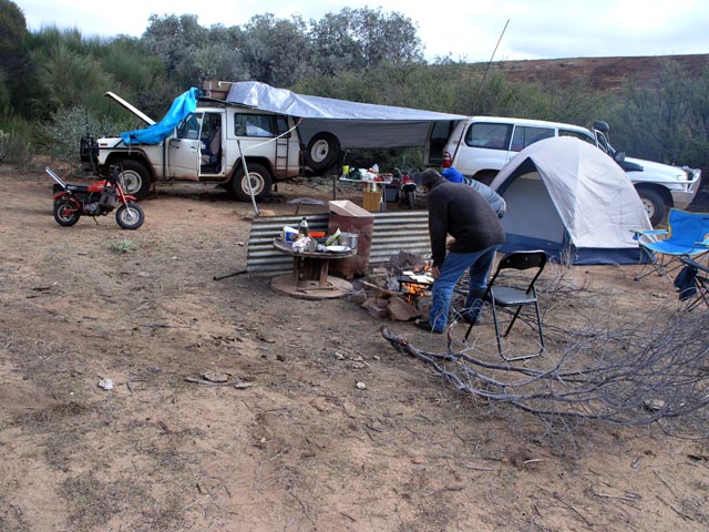
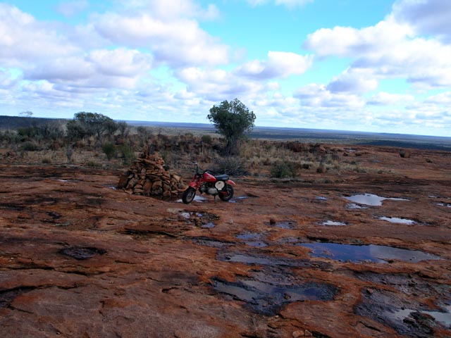
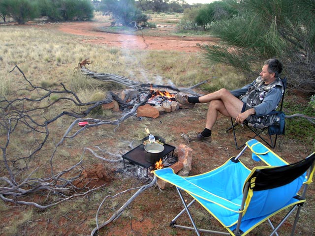
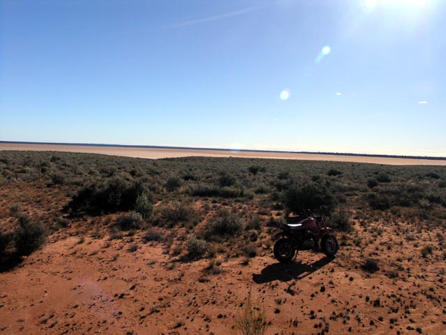
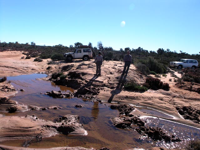
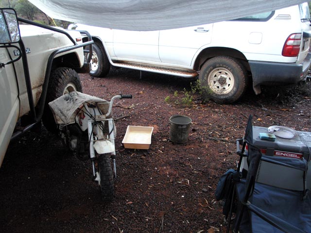
First camp site at Pigeon Rocks. Looks like the main windmill there is no longer being maintained as the tank was bone dry and the mill was not rotating. A real pity since it was a good supply for drinking water. At least on this trip we never had a lack of water due to rain coming every few days. We have the tarp spread between the two 4wds in anticipation of possible rain. Best to have things set up rather than trying to get things in place as the rain is coming down...
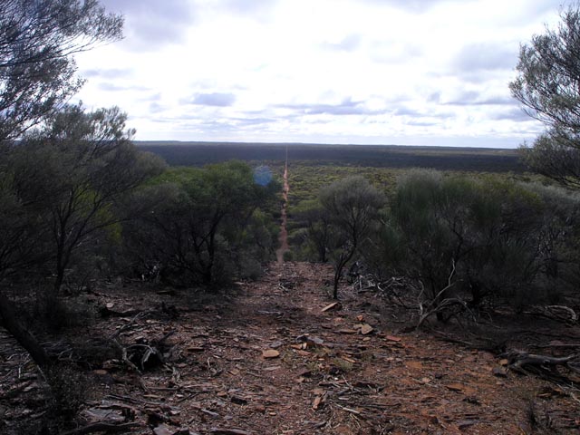
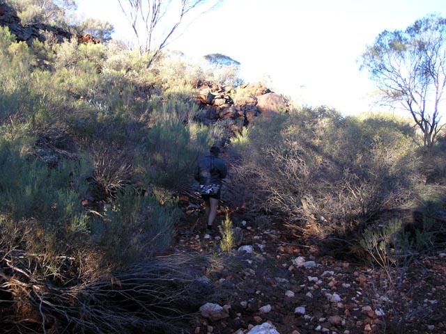
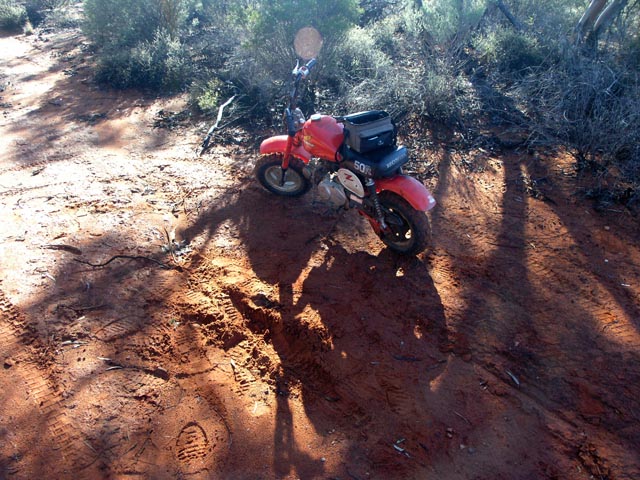
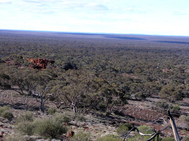
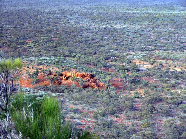
Lionel & I went for a minibike ride to check some of the area out north of Pigeon Rocks. This is a peak on a range that is the western edge of the system than contains Faye's Bluff. This is a view north and this track spur ends at the top of the ridge. Good spot for some pictures of the surrounding area and Pigeon Rocks is quite visible from here (to the south).
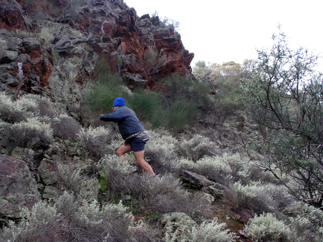
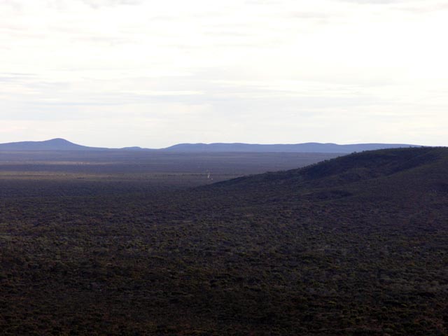
This is the south approach to the same ridge as above - no wonder there is no track running over it.
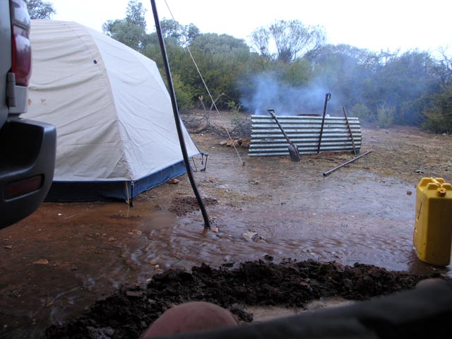
Back at the camp at Pigeon Rocks and it is raining. We had to quickly build a moat around the area we were sitting under the tarp to keep the flowing water away. Later during a let up we built a moat around the 4wd, tent and fireplace to redirect water - worked well. Of course the next day was dry & mostly sunny. Click here to download a wmv file showing the rain coming down rain_video.
The next day, beautiful weather and heaps of water in puddles on the top of the outcrop. One of the minibikes parked next to the cairn on top of Pigeon Rocks. In the evening we climbed up to this area to 'lay' on the rock and look for satellites and shooting stars. Just after the sun fully sets you can often see the reflections of sunlight hitting satellites as they travel across the sky. The common ones are the east/west satellites, but you can sometimes see the much less common north/south (polar orbit) ones.
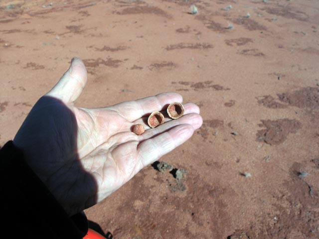
I went for a bit of a ride with the minibike and found a Quandong tree/bush and collected a bunch of the fruits/nuts to nibble on. Not a very exciting taste, but makes for a reasonable snack versus chewing on a rock... These were 'fresh' nuts at the base of a Quandong tree versus ones that emus had eaten (digesting only the soft outer fruit) and then re-depositing elsewhere :)
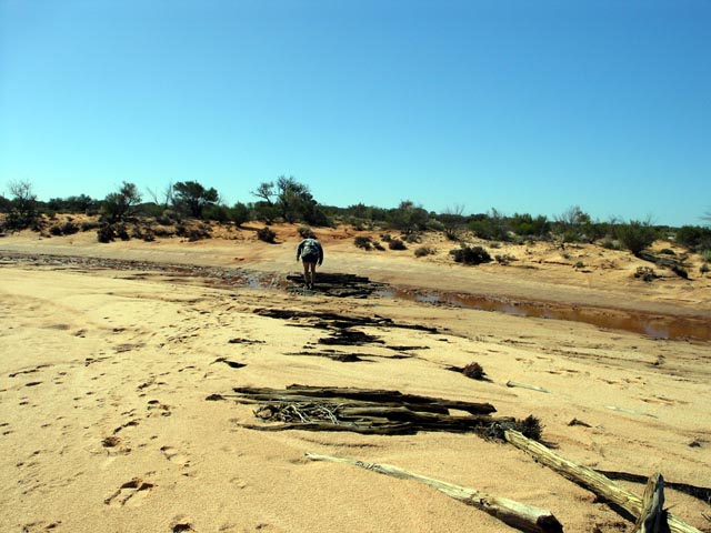
Heading up around the western edge of the east most arm of Lake Barlee. We were attempting to see if there was a track heading up to Ward Springs from the lake side. This was one of the crossings with the remains of trees laid across the track to prevent sinking in the mud on the crossing. Since at this point Kim had returned to Perth for a few days we were in a single vehicle and it makes sense to walk/inspect such crossings versus sinking in them. Quite a few animal tracks, most obvious kangaroo, but no vehicle tracks.
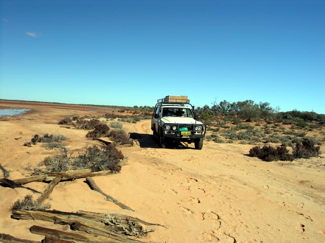
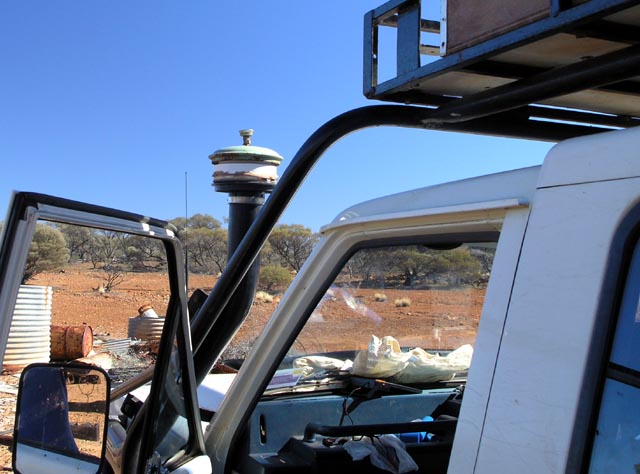
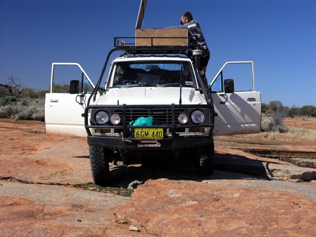
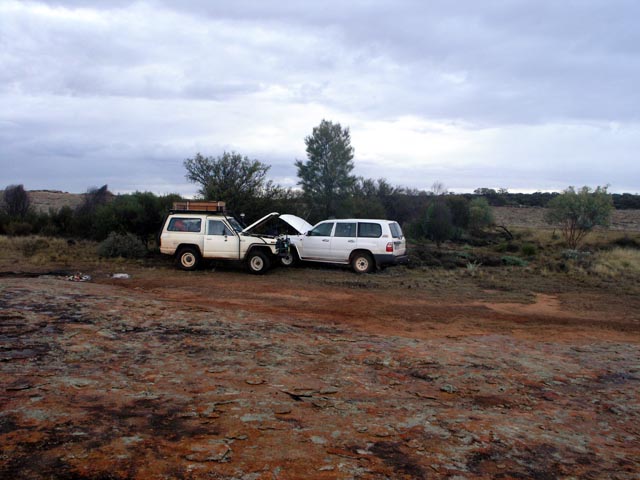
The same crossing looking south at the nissan. No signs of any vehicle tracks means this isn't an often visited area. It was also at this point that we noticed that the top lid of the Donaldson pre filter had vibrated loose and had been lost somewhere prior to this. The plastic bowl was still on there, so we removed it. Later we just wrapped an old t-shirt over the opening to prevent larger debris from falling down the snorkel. Later yet we built a temporary replacement from scrap.
We ended up not finding a track up to Ward Springs along the lake edge, so we returned to a track leading in and camped at a clearing. We then rode the minibikes about 10k up the track to the water course that feeds down into the spring and then headed cross country until we were within a k and then hiked in on foot using the GPS to take us to springs marked location. There isn't a spring as such, but a very tight water course that funnels through a reasonably tall gully of mostly quartz. I can easily see that with a bit of rain the spring area would contain water with just a bit of digging at the bottom of the water course.
Anyhow, it has been an area that I've wanted to visit for many years - given there aren't many locations in the goldfields that show and name a spring on the maps.
The next day we headed up to the Mt Elvire homestead (now a CALM reserve) since we've been there previously and there is a well stocked rubbish dump there - perfect place to fossick for some bits to build a cyclonic pre-cleaner lid replacement.
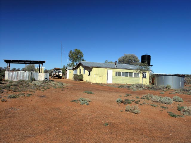
The 'spare parts' department at Mt Elvire Station. Fortunately CALM hasn't buried it yet - so lots of stuff to choose from for the rebuild project.

After some searching I found a nice saucepan lid (green) and a possible plastic body. Lionel has a fry pan as a possible lid and is getting some 1/4-20 nuts from an old oil bath filter. Later I found a better plastic section (some joiner piece) that was a great fit for the saucepan lid and the Donaldson base. We needed to drill a hole in the lid to fit over the threaded rod that normally retains the lid and found a 0.22 caliber is a perfect drill and just the right diameter :)
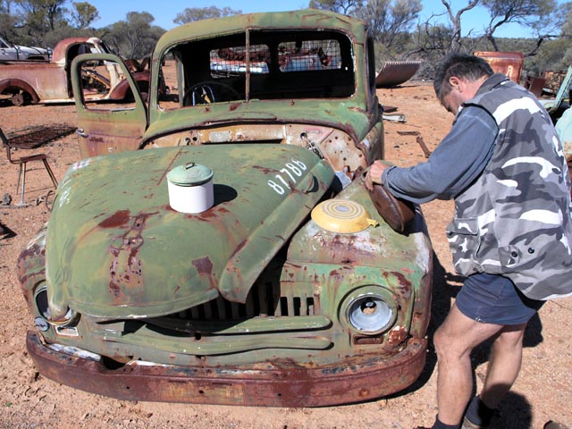
The finished replacement, some excellent bush bodging with only the best possible spare parts from the heap. We used an old radio aluminium volume knob as the 'lock nut' by screwing onto the threaded rod and forming a thread as we forced it on. Lasted perfectly for the rest of the trip and added some interesting character to the whole snorkel affair. Probably added at least 5HP to the engine output :)
Heading south from Mt Elvire homestead we stopped at a rock outcrop on the side of the road for some lunch. All the food is stored in the box up top - makes it easy to see the available options for a quick lunch.
Finally at Johnson Rocks to await Kim's arrival later in the evening of the next day. Lots of water in the large covered hole. This spot has been a standard stopping spot for many trips over the years. Excellent water and LOT's of it! In years past (more than 10 years ago) the pump actually worked and you could have a COLD shower under the pipe while someone cranked the pump handle. Unfortunately the seals have perished over the years and the pump no longer works (sometimes it can be made to work by opening it up and priming it with a few buckets of water).
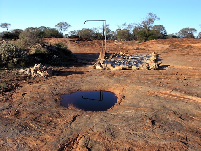
Lifting the lid reveals a nearly full water hole. Must be 1000's of gallons of good drinking water in there. The water runs off the rest of the rock when it rains out there and collects in the 'tank'..
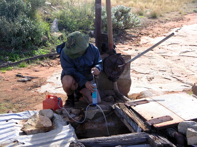
Lionel loves flies - hence the fly net. Busy pumping the water filter to remove any 'enhancements' that nature may have added to the water and refilling our gallon. We have 20 litres in a plastic jerry, but the 'gallon' is handier for dispensing water for drinking/cooking.
One fire for warmth (can be big) and one small fire under the bbq plate for cooking. Cooking up dinner - food always tastes better in the bush. It's a tough life in the bush :)
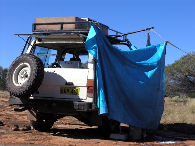
After a week it seemed a good idea to have a shower. When you can smell yourself it is usually a good indicator that things have got pretty disgusting :)
A shovel shoved into the roofrack makes a great support for a solar shower. Not having patience to wait for the 'solar' part of the shower we just heat the water up over the fire. A small tarp makes a great windbreak and parking on the rock outcrop provides a clean 'floor' for the water to run off without turning to mud. So luxurious!
Kim has finally arrived and met up with us. Freshly refurnished with a heap of meat and other goodies he starts to cook dinner. I think he miscounted how many of us there were since he was cooking enough food for about a dozen people. Needless to say there was a lot of leftovers for the next day or two...
Figured I'd go for a minibike ride south of Johnson Rocks. The track has been recently bulldozed/graded and is an easy drive versus a few years ago. This picture is at a claypan so it is always wide/clear and nice in this area. This is just inside the Mt Manning nature reserve. To the west (right) is a salt lake that isn't visible from the track, but it is marked on the maps. So I drove the few hundred metres to a rise that then allows the salt lake to be seen.
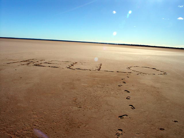
Top of the small rise that surrounds the eastern side of the salt lake and hides it from the track. Parked the minibike and then walked down to the lake to leave a message. In years gone by we had driven past this salt lake without even realizing it was there (since it's behind the small rise). Of course now that we have GPS and realtime mapping software it's pretty hard to not 'see' neat things that are just a few hundred metres off the track.
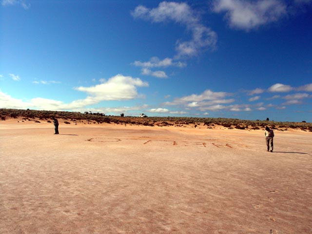
2 metre high HELLO to welcome future travelers - well, at least till the next few rains wash the evidence away. The lake is somewhat soft but can support you when walking on it. I would NOT want to drive a vehicle on it - it would be a very messy and lengthy extraction process.
The next day we left Johnson Rocks and headed south on the same track with the 4wds. Poser shot of Kim's 105 driving over the salt bush.
Took the nissan down towards the lake edge - too lazy to walk. You can see the height of the sand ridge that has formed on the eastern edge of the lake. A small water course has eroded a path down to the lake edge.
Down on the lake again. Lionel is busy creating a big circle around the HELLO. Maybe another time we'll try for crop circles :)
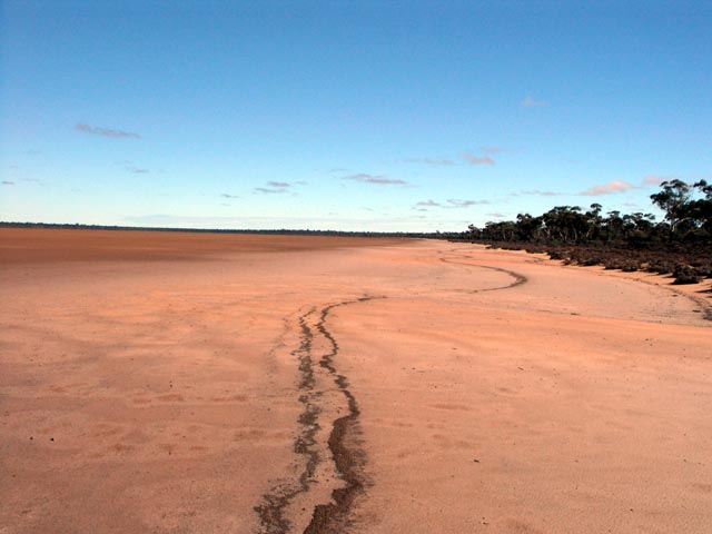
Another salt lake further south from Johnson Rocks. This one has the track running down to the lake edge. Must have been a lot of water in this lake recently since lots of leaf debris has settled on the 'high tide' mark. I hadn't noticed this on previous trips - so the water must have been a more recent event.
Top of Bonnie Rocks. This outcrop isn't named on any of the maps I have, but an old sign (now lost/missing) at Johnson Rocks pointed south and named this rock outcrop and the distance from Johnson Rocks. On the right of the picture can be seen a small lake/claypan that still has water in it. Pretty boggling since this is only the beginning of winter here.
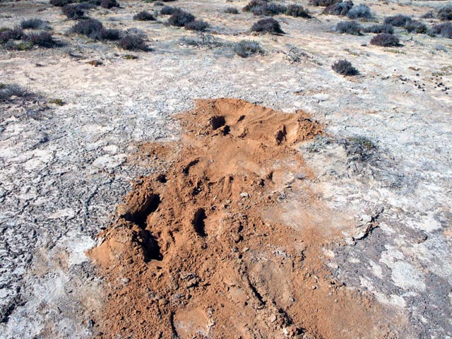
Near the water filled lake, the signs of recent camel activity. Given how fresh the dirt is the camels were likely here just minutes before we arrived and bolted when they heard the 4wds coming down the track. I've never seen camel tracks this far west so something has caused them to migrate out of the desert. Maybe it is getting drier out there...
Even further south of Johnson Rocks, just before the Tee to head to the stone hut (west of us). A small crossing in salt lake country and the HUGE remains of a serious bog event. The 'mounds' have been placed there by an excavator. From the looks of the ruts and wheel marks a large truck with large/balloon tyres was seriously stuck here. We just drove around the hole and easily got across in 2wd.
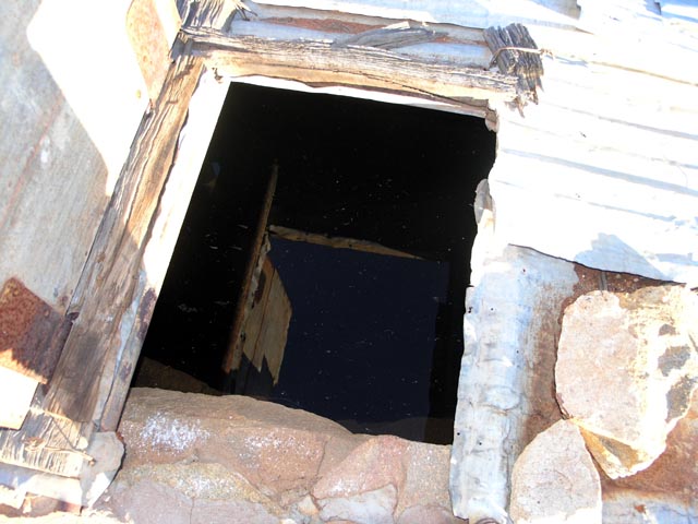
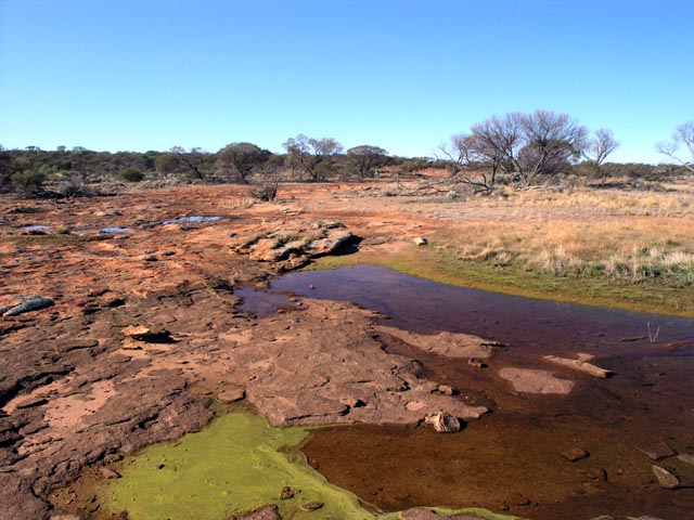
Arrived at the remains of the Stone Hut - supposefly named Reid's Hut on an old map that Rod has. The hut is on the southern end of a nameless rock outcrop and this is where we camped for a few days. Lots of water on the outcrop that is always handy for washing plates/pots and pans etc. On most trips, especially in winter, most of the water that is used is for washing versus drinking. So, having standing rain water means we only use the water we carry for drinking/cooking.
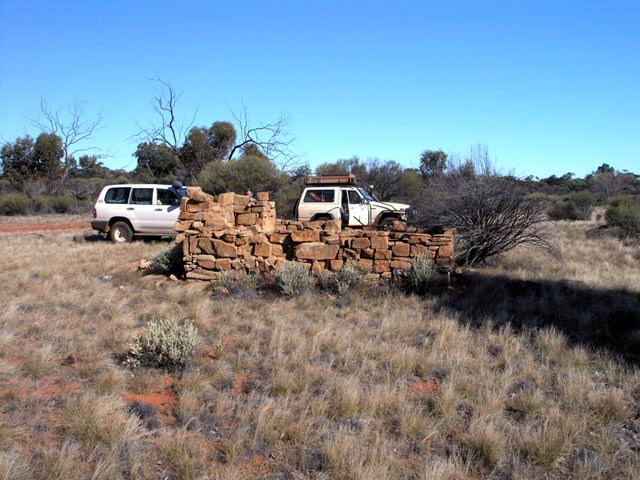
Old rusting drum next to the Stone Hut. Oldest date is 18/7/1957 by R.Dimer. Dimer was a dogger and his name (and the names of some of his kids) are on many of the old signs out on this side of the goldfields.

The outcrop that is near the Stone Hut, Again plenty of water on the rocks and a beautiful day.
Lionel & I went for a minibike ride west of the Stone Hut to visit another nameless outcrop that we've stopped at before. Signs of more heavy machinery being bogged near the outcrop. Outcrops can be very tricky after rain since water will shed off them and collect in soakage areas making the ground extremely boggy - I can speak from experience :)

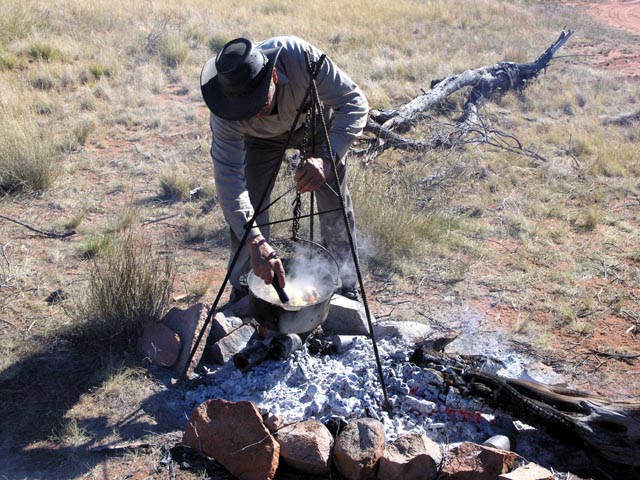
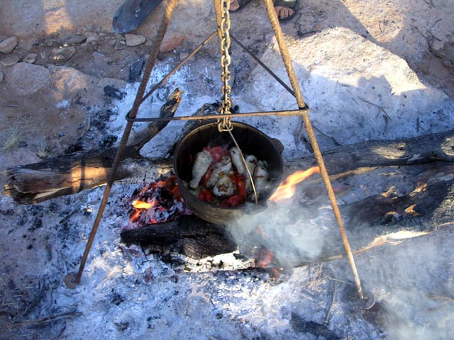
Kim doing his best to feed the masses. Chicken drumsticks with tomato and various other 'stuff' cooking nicely in the camp oven.
The nissan helping get the 105 started. Kim had run down his battery running the fridge the previous day. The battery was quite dead and it required a few minutes for the nissan to put enough charge back in to achieve the jump start. Time for the installation of a dual battery system.
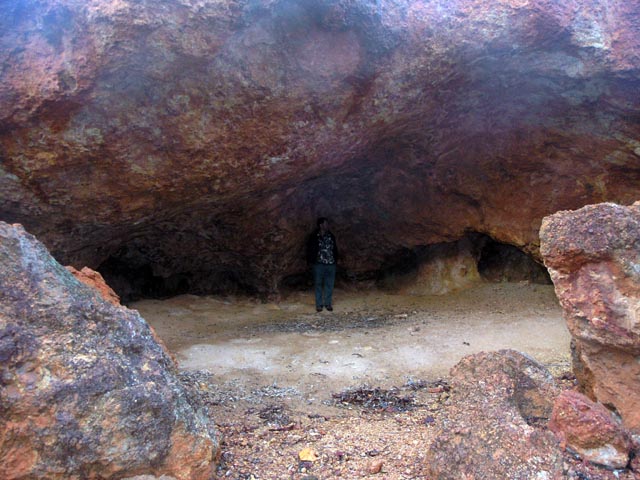
About 1/2 way up the eastern side of the Mt Manning Range there is a neat outcrop that has many caves and undercut areas. Large enough to provide plenty of cover when it rains. The local kangaroos have made a haven out of the place as witnessed by plenty of droppings.
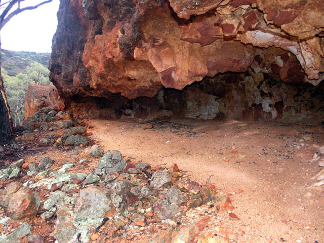
More of the undercut areas on the western side of the outcrop.
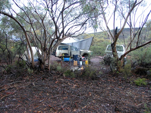
We are camped just east of the outcrop and you can see part of the Mt Manning Range in the background. Given we had arrived with a light sprinkle of rain we quickly put up the tarp to provide a dry area to sit, cook and eat. During a break in the weather we also put up our tent (for Lionel and myself). Kim slept in his 105 - slack!
When the rain came down the tarp allowed us to collect lots of fresh rain water. Filled the bucket and the washing container was filling up again. Needless to say we had more than enough water at this location.
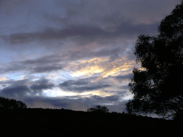
In the evening the clouds started to clear and we had some nice sunset pictures as the sun hit some of the clouds.
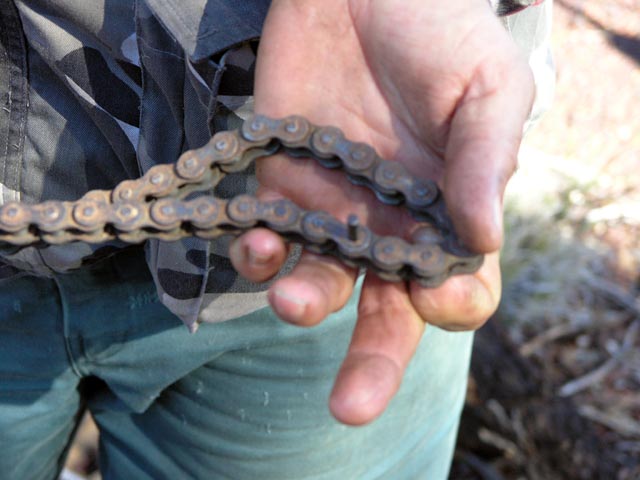
The next day Lionel & I were heading north along the east side of the range when a stick managed to derail the chain and before I knew it a link had snapped. Amazing after so many years (the bike was new in 1982...) this was the first time a chain had broken. Lionel went back to camp to get some rope and then towed me back.
We removed the broken link pair and then re-pinned the chain. Fortunately the chain is old and stretched so there was enough adjustment in the rear wheel to allow the shortened chain to still work well. Unfortunately this was only a short lease on life since 3 bolts had stripped on the hub assembly and the rear wheel was wobbling all over the place. It would require a repair that was only possible at home by re-tapping larger threads into the hub. Oh well, it was the last days of the trip so the loss of use of the minibike wasn't a big deal.
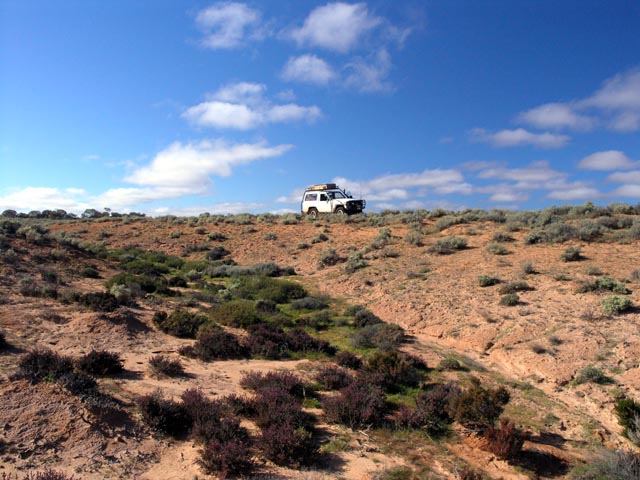
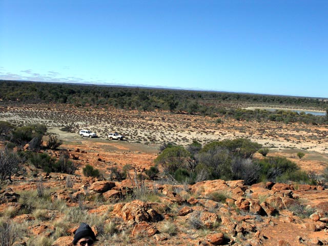
In the afternoon I climbed to the top of the range I took some nice pictures in various directions. This picture shows the outcrop and gives some indication of how flat the country is in this area.
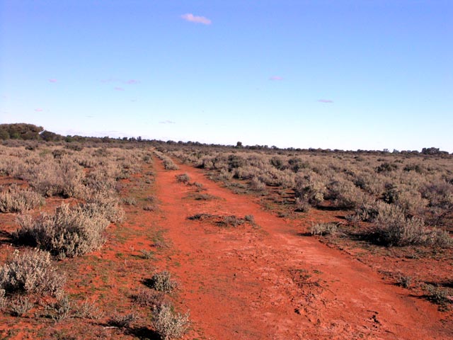
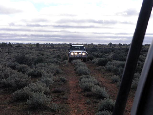
This is a view from the top of the range looking west. In the middle of the picture you can make out the track on the other side of the range that heads west back to the Bullfinch/Evanston road. The track has been graded and is far different from when Lionel & I first drove it in 2000. The track then was VERY run down and overgrown. We had to stop many times and get out to search for where it headed. Now you can sit comfortably on it at 40kph most of the time.
A more zoomed in view of the outcrop and you can make out the camp just to the top right of the outcrop. The range side of the outcrop is the only part that has the caves and undercuts. There is a pretty major water course on that side and I'm guessing that is what caused the erosion over the millenia. I've only rarely seen such formations in the goldfields (not much rain...).
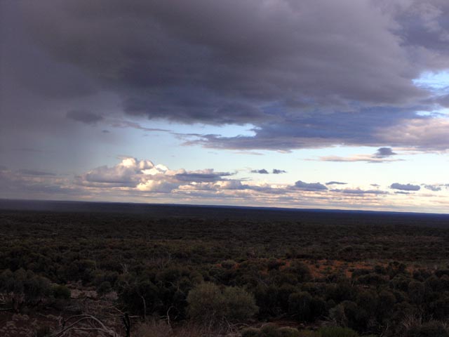
The next day had some serious cloud appearing in the sky again. A downpour is happening to the north of us, fortunately it passed us and the camp by without a sprinkle.
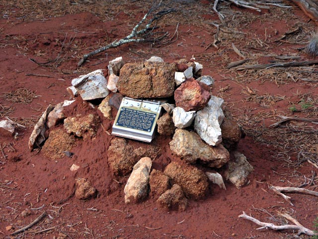
The next day we headed to the Mt Manning meteorite site, first time for us since we located the area back in 2005. Rod had brought rock in to make a bit of a protective cairn around the plaque. We did some basic maintenance, Lionel added some more dirt to the cairn to hold the rocks in place after the following picture was taken.
The drive back out to the main shot line - Mt Manning Range in the distance (due west of us). Lionel had done a donut with his minibike - loony at heart. Parts of the track are in very good condition, some a bit overgrown. The entrance is really the problem area since it is in a bit of a water course and so quite overgrown - until we did some 'maintenance'.
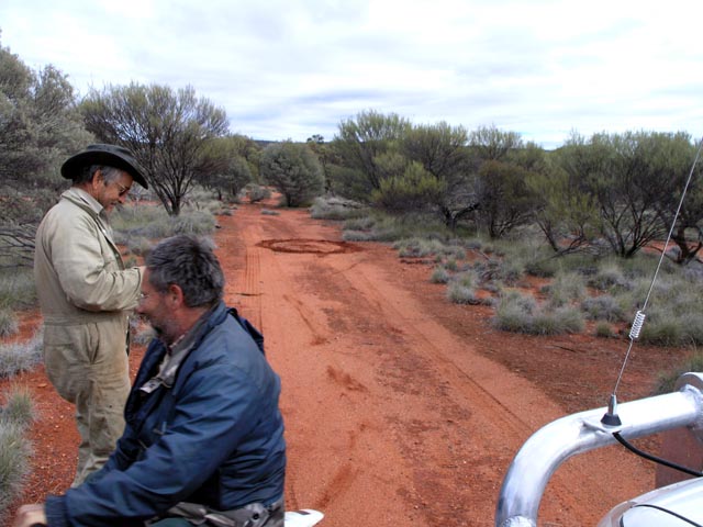
After about 45 minutes with shovel and axe the three of us had totally transformed the track entrance to 'super highway' status :) One would need to be blind now to not see the track entrance!
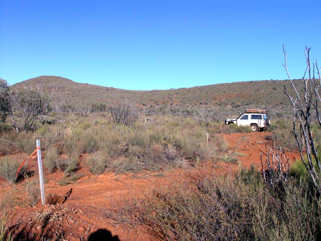
A picture showing just how well the track is now cleared. The nissan is on the north/south shot line, so basically a T-junction. The picture shows Mt Manning range to the west in the background. The track east to the meteorite site is easier to see than the shot line now...
And that's the end of the trip. We then headed home via Bullfinch and were home by late afternoon. We were met with clouds and rain as we approached Perth.
Bit of history about some of the area:
The first explorers to traverse the Northern Yilgarn area were the Gregory Brothers who named Mt
Jackson in 1846 while searching for good grazing country. The country was extremely dry around Mt
Jackson in August 1846 and so the brothers left the area disappointed.
In October 1875, Ernest Giles travelled through the Northern Yilgarn area on his expedition from Port
Augusta in South Australia to Perth in Western Australia. In his journal from this expedition he makes
note that the composition of Mt Jackson was “almost iron itself, and there were some fused stones like
volcanic slag upon it.” Giles named Pigeon Rocks on this journey as a result of catching many bronzewinged
pigeons (Giles E. 1889).
In 1869, John Forrest skirted the very northern edge of Mt Elvire and named Lake Barlee after the
Colonial Secretary of Western Australia. Forrest also named Mt Elvire after his wife Margaret Elvire
(Hammersly) Forrest (Forrest 1875). Forrest also named the Helena and Aurora Range after the
daughter (Helena Aurora Munger) of Henry Munger of York (pers comm. Ian Elliot, 2006).
In 1888, the Yilgarn Goldfields were declared and by 1894 two goldmines were operating near Mt
Jackson. Small quantities of silver were also produced as a by-product of gold mining.
Malcolm Campbell Ross of Menzies first took up Mt Elvire Station in 1966. Formerly a sheep pastoral
station, it was never fully stocked or developed. In June 1991 CALM purchased the station under the
SCARP project.
![]()