2 Week trip
to the Kalgoorlie Goldfield area
Another trip to the bush, all up a total distance of about 1800km.
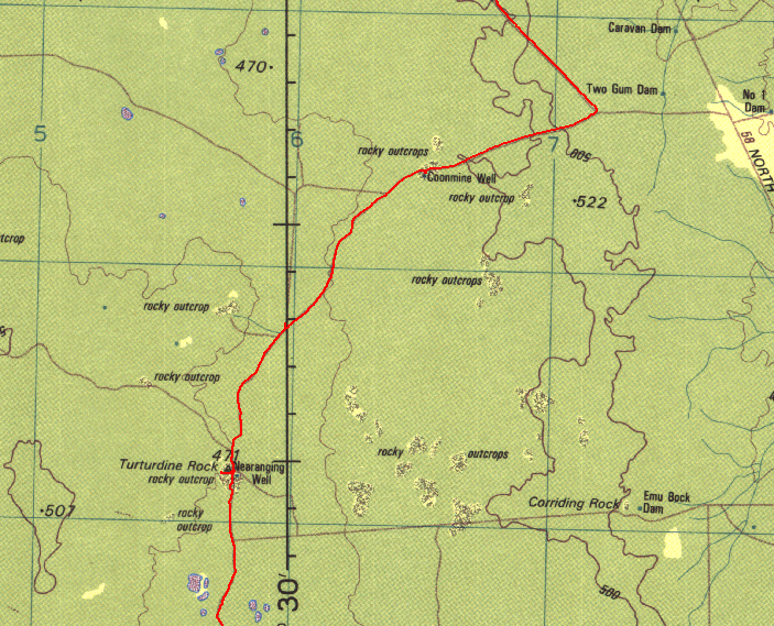
The basic trip was from Perth to Bullfinch and then up to Pigeon Rocks. From there we went up east via the Mount Manning Range and then up to Johnson Rocks on the Evanston-Menzies Road Then east towards Menzies and north at Hospital Rocks to Lawrence Find and then east/north up to Metzke's Find. From there south again and via Lemon Rock/Galah Rock and back down to the Evanston-Menzies Road and to Mulline. From Mulline we headed south via Davyhurst and then to Callion via some back roads. From Callion we took an old track down to Coonmine Well/Rocks and via Turturdine Rocks and Jaurdi to the transline. We checked out some of the mines just north and south of the transline near Jaurdi and then followed the transline west towards Koolyanobbing, but headed south along the east side of Lake Seabrook. The track then wanders through some tight/thick scrub and starts to open up eventually. We reached Weowanie Rocks and had a nice wash, lots of water there. Then south to Yellowdine and back to Perth along the highway.
It was a nice trip and revisited some old places and a few new spots and tracks..
Following are some of the pictures from our trip. The participants were:
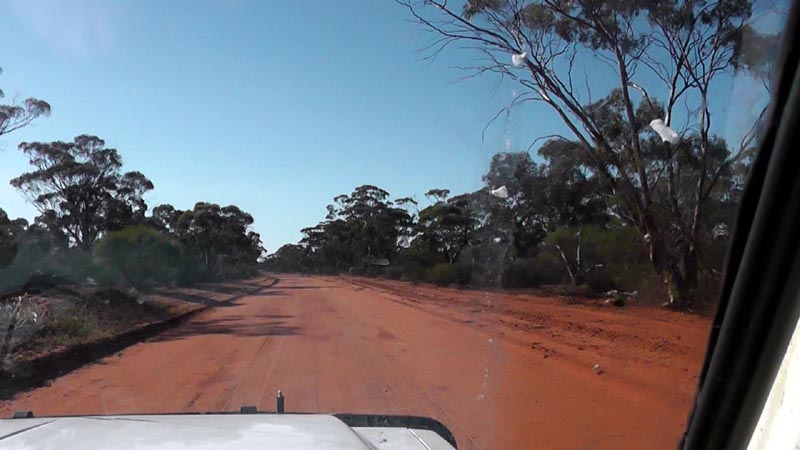
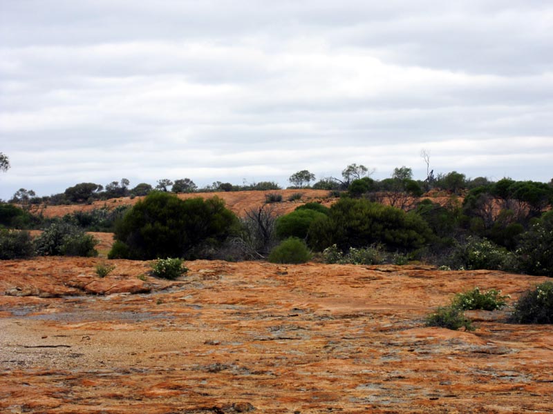
On the Evanston Road heading north. The road is in excellent condition and we make good time comfortably sitting on 80k/hr. Due to recent rains very little dust is being thrown up as we zip along.
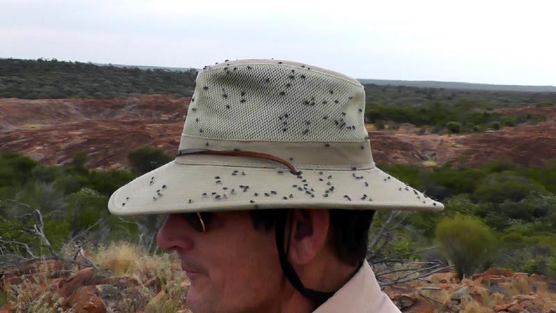
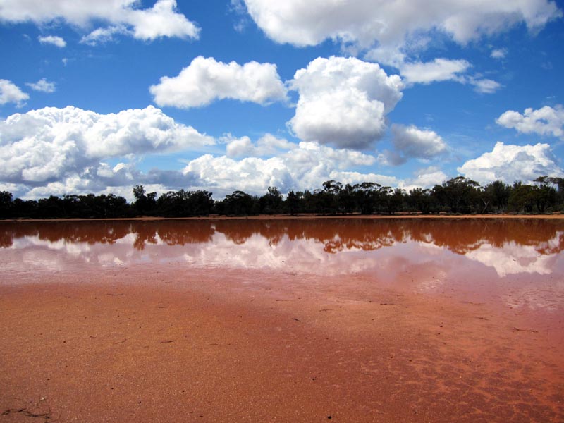
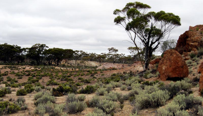
Pigeon Rock and David gets to make new friends with the local fauna...
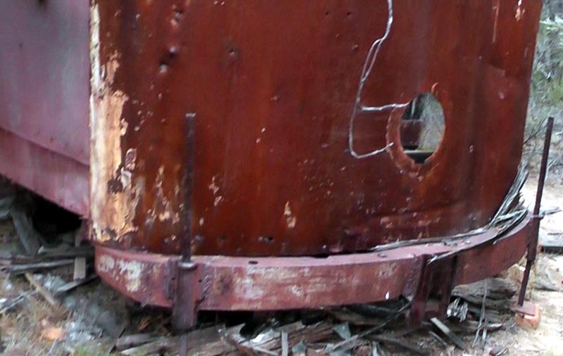
Old tram at Pigeon Rocks. What they were thinking in bringing this old relic so far out into the bush I have no idea. The tram is decomposing rapidly now and not much is left of the inside wooden floor.
After a bit of a shower I caught some video of water running off the outcrop. Later we walked around the rock and it was interesting to see the various paths that water would take to run off the rock.
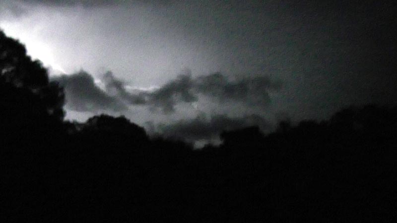
Yeah, lighting, thunder and rain greeted us at Pigeon Rocks. Mostly a light rain so not a big problem. We had set up a large tarp off the back of the nissan, so that made it nice to be able to sit out and enjoy mother nature's show without getting wet. I caught this image using a digital camcorder and then frame grabbing a picture from the video.
. Heading north along a track to Faye Bluff, just east of Pigeon Rock.
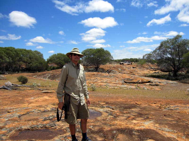
Hiking to the edge of Faye Bluff to the western entrance that allows you to climb to the top of the bluff. Let's hope the mining companies don't decide that this is another chunk of iron ore that they must export to China...
Top of the Bluff and standing on the edge to catch a view of one of the vertical faces. Not the time to sneeze and slip :)
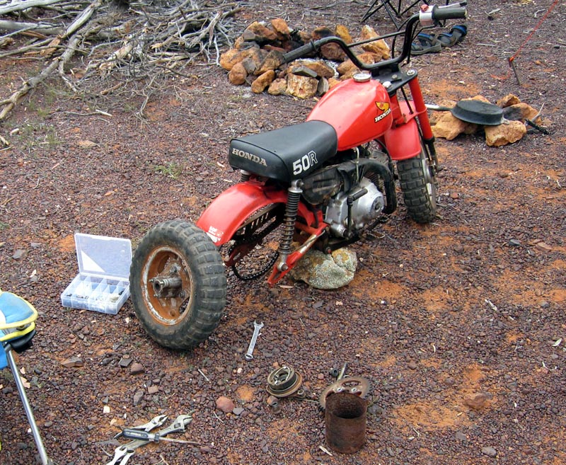
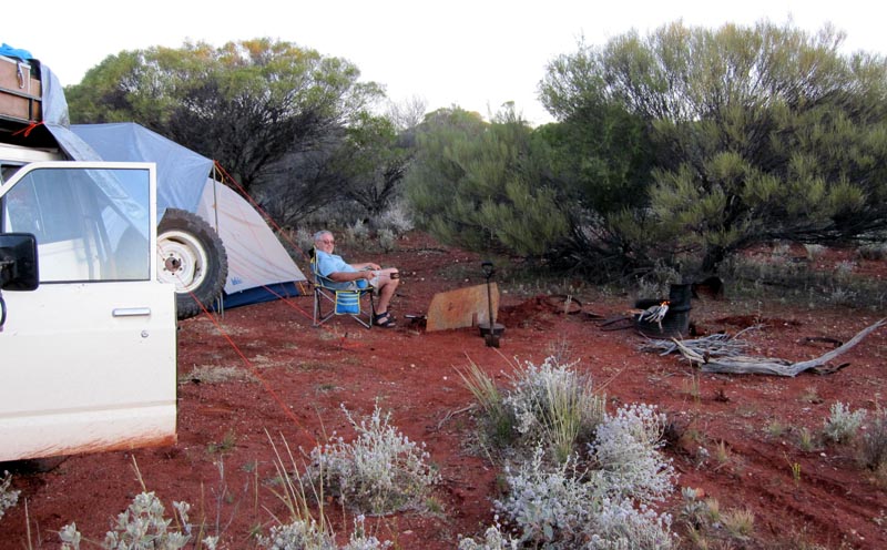
Camped at the Mt Manning range on the east side. Seems like a cursed location for the Z50, 2 years back I snapped the chain while here. This time the 3 bolts that hold the wheel/rim to the hub/brake assy backed out and 2 fell out. I got back to camp with wobbling rear wheel and one bolt barely holding things together. Fortunately the threads hadn't stripped out of the aluminium hub and my 'spares' box had the correct replacement metric bolts. I worked some metal epoxy into the holes to 'lock' the new bolts in place and all was good for the rest of the trip.
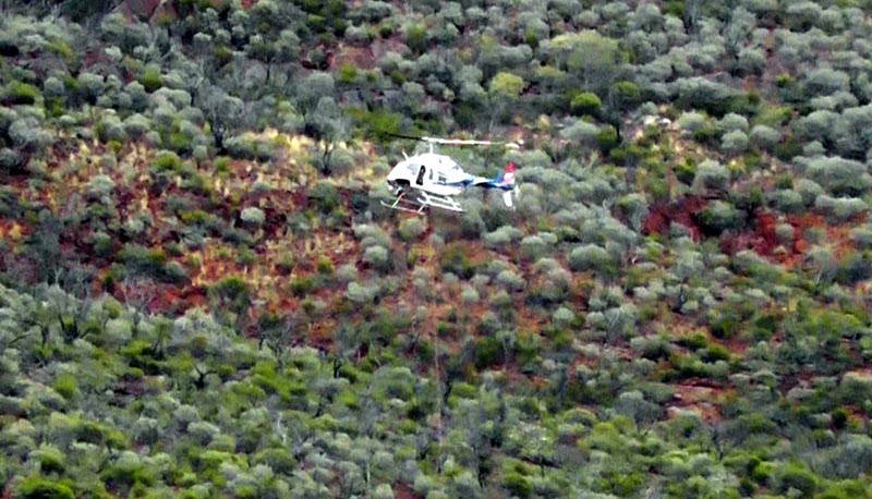
David went for a hike to the top of the range and one the west side he spotted some "interesting" goings on. A few folk on the ground with some large containers with equipment hooked to a cable under a helicopter. Here's the containers and a few of the 'workers' (just visible).
Picture of helicopter with cable hanging underneath. Now the entire area around Mt Manning is named "Mt Manning Nature Reserve", though unfortunately that hasn't stopped a mining company from getting a license to explore within the nature reserve -> http://www.salmonriverresources.com/s/Mt_Manning.asp
Hopefully this won't lead to more mining/devastation with the typical "dig a big hole" and leave it for another generation to deal with.... I wonder what our kids will inherit from our generation of short term profit driven greed. Iron ore mining is very intrusive to the land since it basically involves removing all the top soil and excavating out the ore. All that is then left is a big scraped off area and piles of debris.
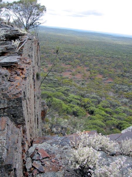
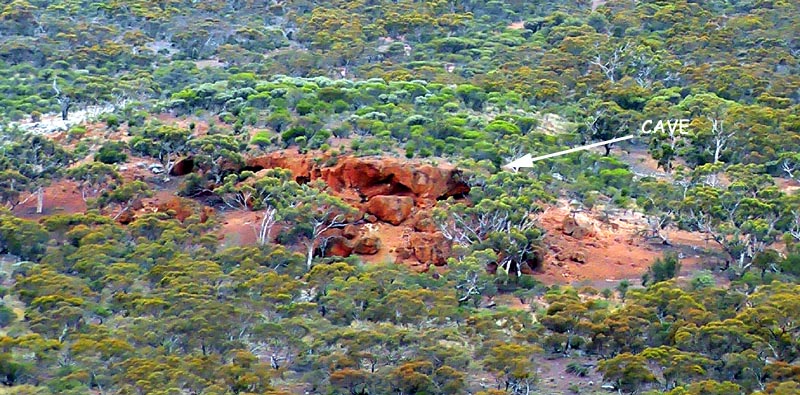
Looking east from the top of the Mt Manning range is this nice outcrop - great place to camp. I've been here a few times now but never explored one of the holes since I assumed it was just another blowout. The picture below shows the cave is on the south side of the outcrop (mostly made of gravel).
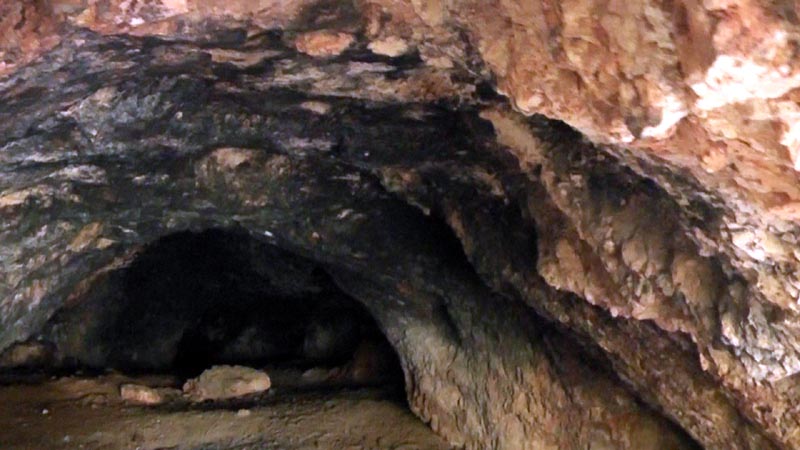
This is a picture looking into the cave. It is tall enough to stand when inside. The 'novelty' is the black soot on the ceiling of the cave, it is from aboriginal fires over many years - obviously from long ago. Be interesting to hear what comes of Salmon Mining's investigation into environmental and aboriginal issues - somehow I can't imagine it stopping their activity...
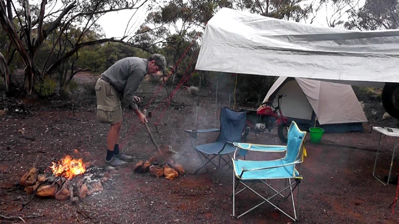
David getting our cooking fire going by borrowing coals and wood from the heating fire. Tarp is up again since we're getting occasional drizzle and rain. This has been the 3rd time I've camped at this spot.
After a day layover at Mt Manning we moved on to Johnson Rocks where we topped up water and also spent a day waiting for the rain to subside prior to heading on.
At Johnson Rocks we took the opportunity to refill our drinking water from the large covered gnamma hole. With all the rain the hole was nearly full and fresh rain was refilling it faster than we could empty it :)
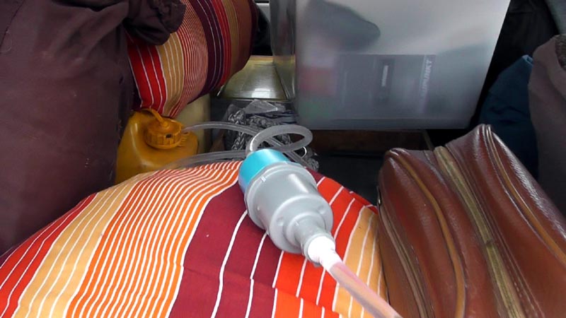
On previous trips I've used a Pur filter requiring lots and lots of pumping. For this trip I decided to try a gravity filtering system instead. Here's a picture of the setup. I modified the solar shower bag to take either the shower nozzle or a hose that could plug into the filter system. I added a charcoal pre-filter to act as a sediment filter with the benefit of the activated charcoal neutralising any flavour in the water. The output of the charcoal pre-filter then feeds into a Sawyer 0.1um water filter and the output of that is drinking water. Even with only a 1/2 metre or so of 'head' there was plenty of pressure to run the system fully as a gravity based filter.
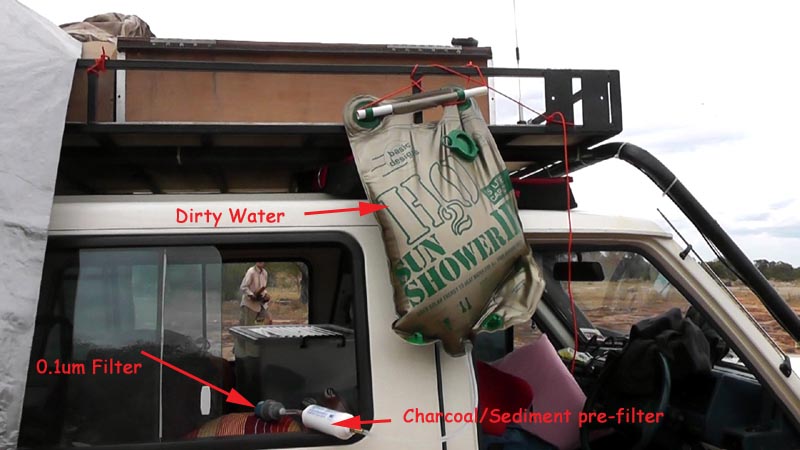
With the 20 litre water container still in the vehicle, I could just feed the output of the 0.1um filter directly into it. With plenty of quality tygon hose I could also run the output of the filter directly into pots or our 1 gallon container. On previous trips I've always had to move the 20 litre container in and out of the vehicle. With the gravity feed scheme, I don't have to move the container and can draw water from it with the same hose and siphon action. Very nice improvement and NO MORE PUMPING :)
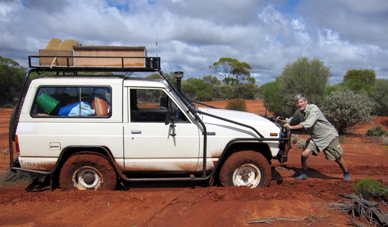
At Hospital Rocks we were entering the track that leads up to Lawrence Find and discovered some mud on the side of the main road. Had to back up and lock the front hubs to allow us to 4wd through the mud and onto the track. Basically a few metres of mud and then it was smooth sailing all the way up the track. David goofing off for the camera :)
On the way up to Lawrence Find we passed a few claypans. This one was next to the track with plenty of unappealing water in it. At least we had a nice break in the weather and some generous amounts of blue sky.
Camped at Lawrence Find and I'm relaxing before we got to work getting the fire going and cooking dinner and making some fresh bread. Lawrence Find appears to be mostly a small show with a LOT of junk left behind including tins/vehicle parts/axle housing, LOTS of broken springs etc etc. David came up with a theory that after not finding any gold they went mad and started to dismantle/destroy everything that they could find :)
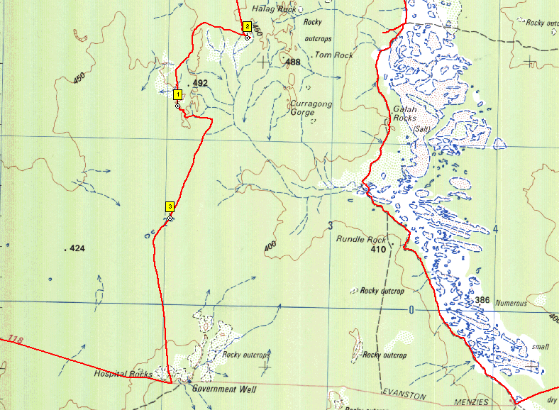
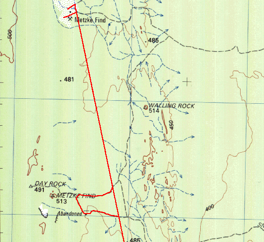
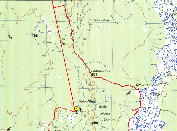
Screen capture of the tracklog from this part of the trip. The #3 marker is at the claypan 2 pictures above. The #1 marker is at Lawrence Find, the location of the above picture. #2 marker is at a neat depression in the following pictures. The red left tracklog is all on tracks and shotlines that aren't shown on the 250k topo raster maps. Some of the tracks ARE on the old Geology 250k maps and of course Google Earth photographic level imagery shows most of the tracks. WHY have Dola/Natmap left this information off the 250k topo maps is anyone's guess...
While planning this trip I had observed a silvery white/blue circle on Google Earth that seemed strange. Given that we were very close to it as we navigated north and away from Lawrence Find I figured we should detour off the main cut line/track to check it out.
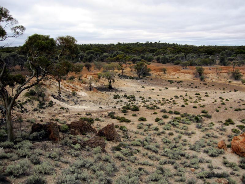
Another picture of the same depression looking north. It is quite apparent that a lot of water flows into this depression when it rains. Quite an interesting area.
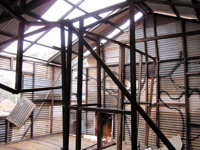
We then headed north on the cut line which is actually an excellent graded road that you can comfortably sit on 80k/hr. Years ago when Lionel & I first went up this way we had to navigate the original track that was fairly overgrown in areas. This new upgraded road makes getting up to Illaara much faster and easier. Unfortunately the old structure is showing signs of major deterioration from our first visit 11 years ago. From the outside it doesn't look too bad.
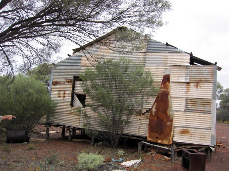
But once inside the extent of the ongoing damage is very evident. Quite a large part of the roof is gone and several of the internal cross braces have broken and I'm betting another 5+ years will bring a lot of the structure down, especially if any large storms/winds go through this area.
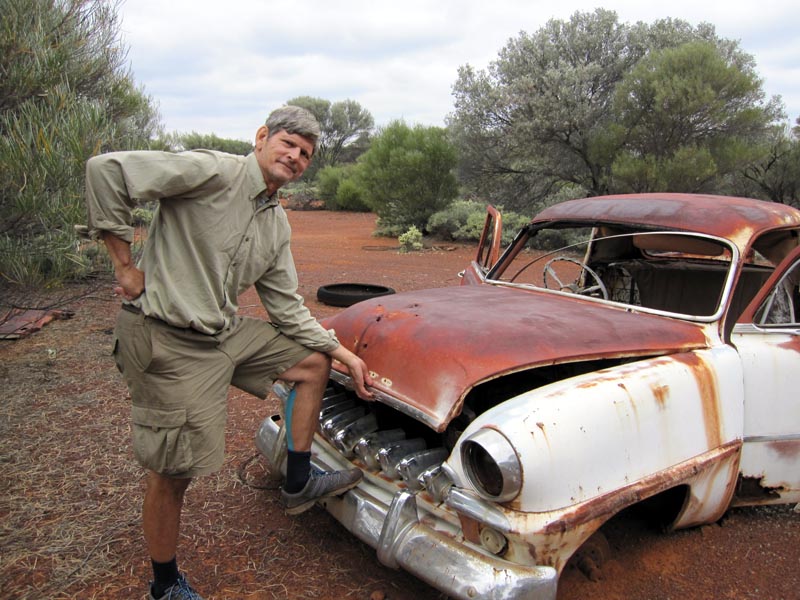
Old DeSoto at Illaara. Doesn't look much worse for wear compared to our 2000 trip, so it is dealing with the weather out there better than the old structure is. Not sure if David is pitching it as a good buy or whether he's wanting to buy it, though there didn't appear to be a salesman in the near vicinity.
Illaara is on the map at the location labeled "Abandoned". Of course on the Geology 250k maps it is named as Illaara and again, Dola/Natmap has left info off the 250k topo maps for reasons best known to them. The red lines are from the GPS tracklogs, you can get an idea of how straight the shot line is from the log! We checked out Illaara and then headed back to the shot line and on to Metzke's Find. We also found the first track leading off to the west will line up with a new track/cut line that heads up the eastern side of Lake Barlee (just east of Johnson Rocks). These are relatively new shot lines/tracks, presumably from more sandalwood work.
2012 updated: On the 2012 trip (see 2012 trip report), it was verified with a professional sandalwood contractor that the 'superhighway' was made by the FPC (Forest Products Commission - government body) to provide access for sandalwood cutting in this area. This work is happening on a large scale with all harvest sized sandalwood being ripped out of the ground by machinery and bulldozer cut lines everywhere to provide access to the harvesting machines. It is quite disconcerting to see how much damage is being done to the native bushland.
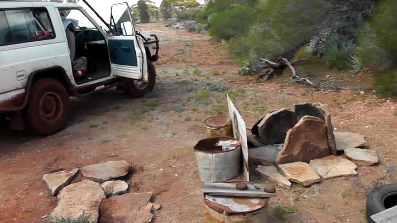
Camped at Metzke's Find, looks like someone went to the trouble of cutting and stacking a bunch of firewood. We used a bit since there was no indication of anyone recently being there, i.e. no fresh tyre marks etc.
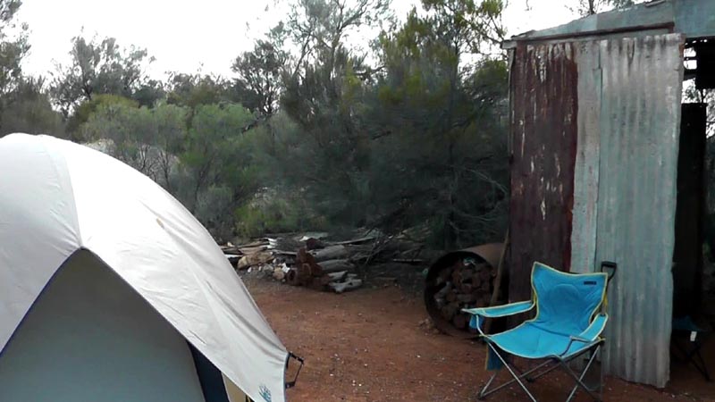
A fireplace already built and ready for use, though we did need to burn out some of the resident ant population from around the cooking area. Lots and lots of little ants wandering around - before our burnoff.
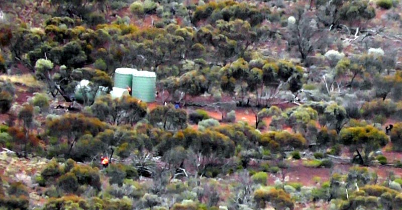
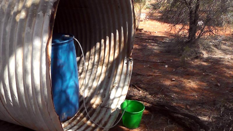
Looks like someone planned or plans to spend a bunch of time here. There were 2 full 200 litre water containers in the old tank. Bit of tygon hose and we had extra water to use for cooking etc. We took at most 10 litres of water and resisted the temptation to have a nice shower :)
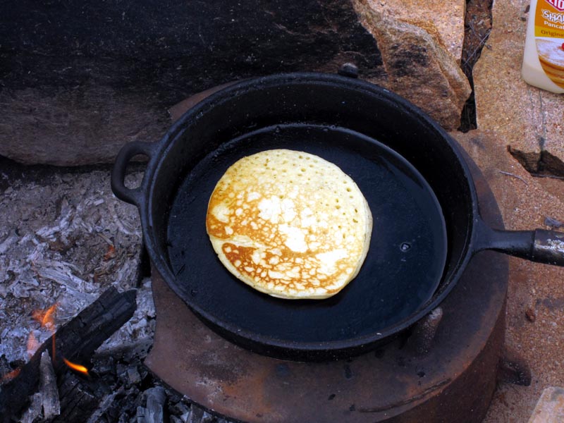
Breakfast was some nice pancakes with strawberry jam. Welcome change from cereal.
We then headed back south along the superhighway we'd come up and then headed east a bit to intersect with the original old track.
From there we headed down to Lemon Rock which had a bit of water on it, but it was apparent not too much rain had made it into this area. This is one of our sunnier days though still on the cool side for this time of the year.
Then on to Crow Rock which isn't a particularly large outcrop and doesn't have the ability to trap much water.
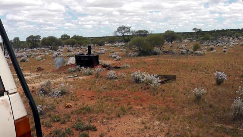
From Crow Rock we went down to Galah rocks and the old cast iron stove is still there with signs of more recent use as a cooking area.
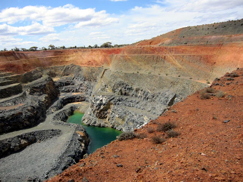
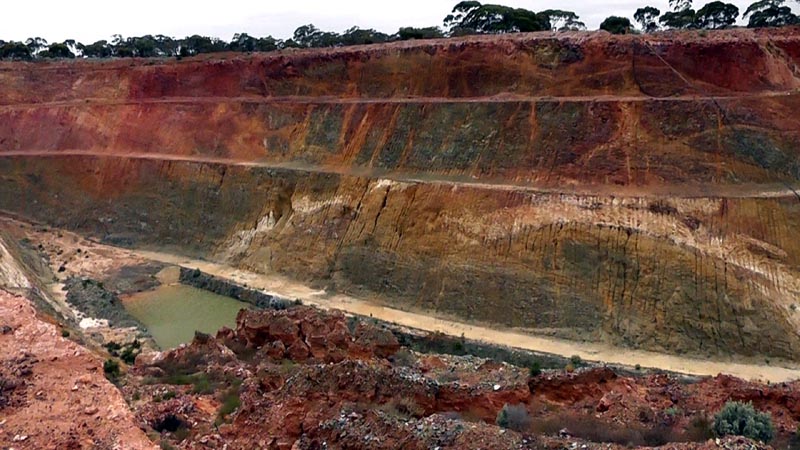
We then continued south and hit the Evanston-Menzies road and headed east to Mulline and then went south again. Checked out one of the big holes left by a mining company and was educated by David (geologist) about oxidization and leaching of sulphur from iron pyrites into ground water to form sulphuric acid. Great legacy that the mining companies are leaving us as they dig hole after hole in the goldfields. Seems that they have an open license to dig their holes and then leave them complete with contaminated water for a future generation to deal with... Those trees in the distance are fully grown gum trees, just to give a bit of an idea of the scale of these holes.
We camped at Wild Cat mine for the night and that's where David had a personal encounter (of the worst kind) with a bull ant. Next morning we headed east to the main road to take us south to Davyhurst
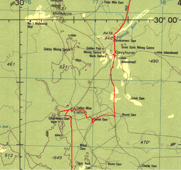
Tracklog of heading to Davyhurst and then the back way into Callion. The track from Daniel Dam north & west to the Callion area is very much lost and requires some walking to find it and a way through some of the muddy areas across the water course that feeds the dam.
Then on to Callion where my father worked in the underground mine more than 50 years ago. I'd been back there a few times and as a kid where we camped in the old mess hall at the mine (abandoned by that time). There was some old buildings including a one room brick/tin structure that my father had made for himself so he could sleep in quiet comfort versus in the rowdy single men's quarters. Of course all that is now gone and replaced with another big hole, very depressing...
From Callion we took some old back roads south and then headed towards Coonmine Well/Rock.
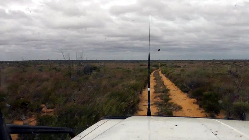
Here's a picture of part of the track heading westerly and getting closer to Coonmine Well - nice open driving across the sand plain.
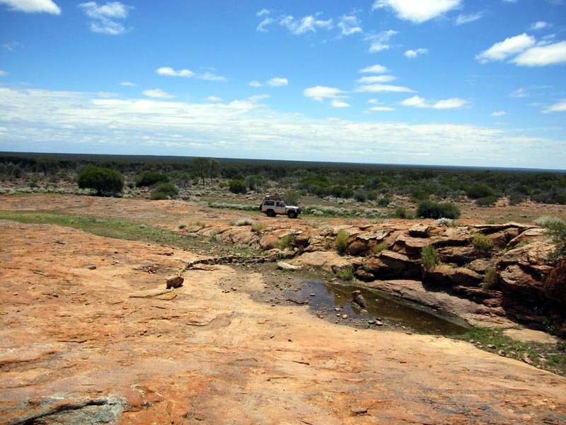
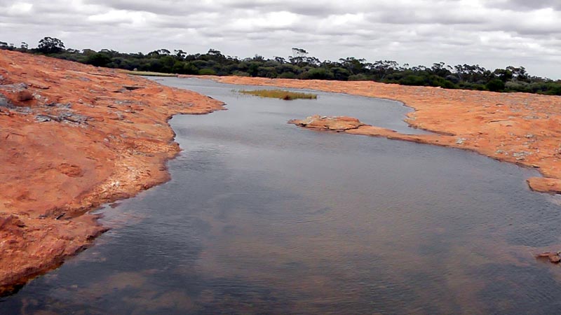
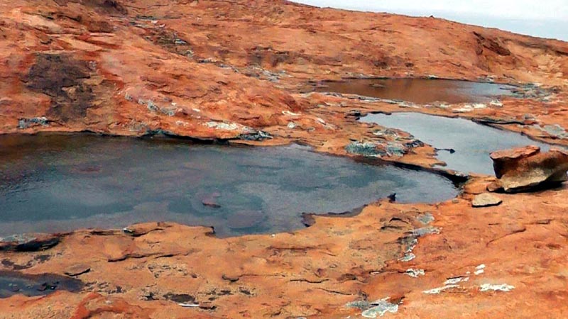
Coonmine Well is at a very nice outcrop where there are some very large pools of water. The picture below is looking north of Coonmine with the well just to the right of the picture.
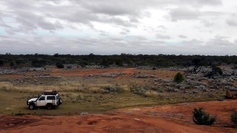
The largest pool of water we found on this trip (other than the pure volume of Johnson Rocks). We certainly had more water on this trip than we could ever use. This was a very nice location and if it wasn't for our need to head back to Perth it would have been a great place to camp for a day or two.
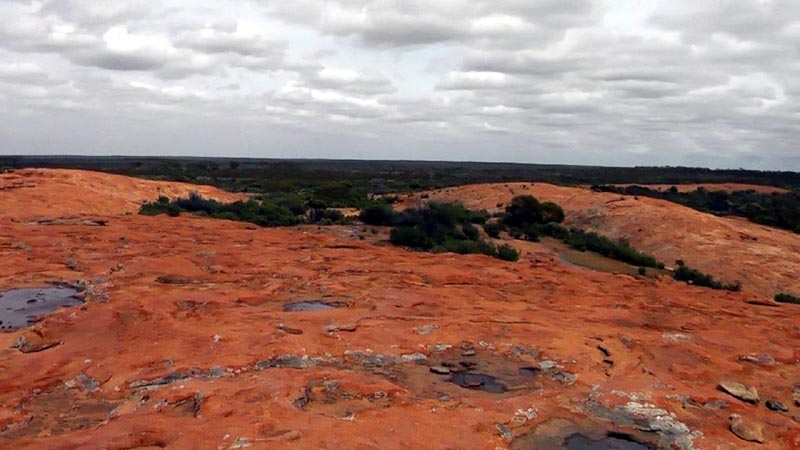
Heading south we reached Turturdine Rock. Another large outcrop with various pools of water all over it.
Top of Turturdine Rock. The rock has some separate sections, so more of a chain than a single above ground outcrop. There's quite a few nice places to camp.
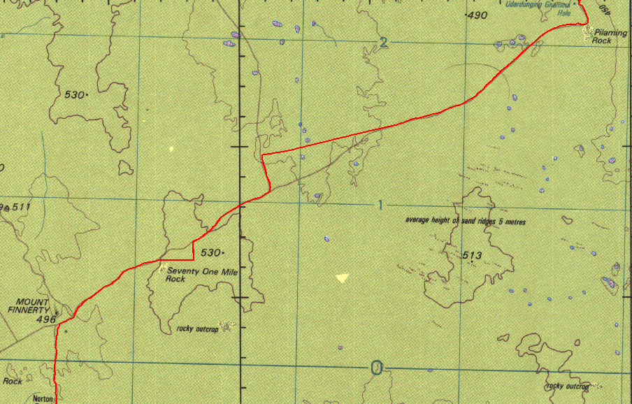
Another part of the map showing the GPS tracklog. Portions of the old track have either deteriorated beyond detection or updated sections bypass some of the older sections.
Heading south we reach Udadunging Gnamma Hole and of course more water. More legacy from the early days of exploration and prospecting as the government provided water catchment/storage infrastructure. I've yet to see what modern mining (big hole style) has done to improve infrastructure out in the bush other than contaminated water at the bottom of huge holes. Modern mining typically involves fly in/fly out, so no attempt to improve any of the local infrastructure other than building a haul road to drag off the wealth for export.
Just south of the Gnamma hole and likely on the same outrock structure is Pilaming Rock. We drove by without stopping to investigate its extent or water catchment ability.
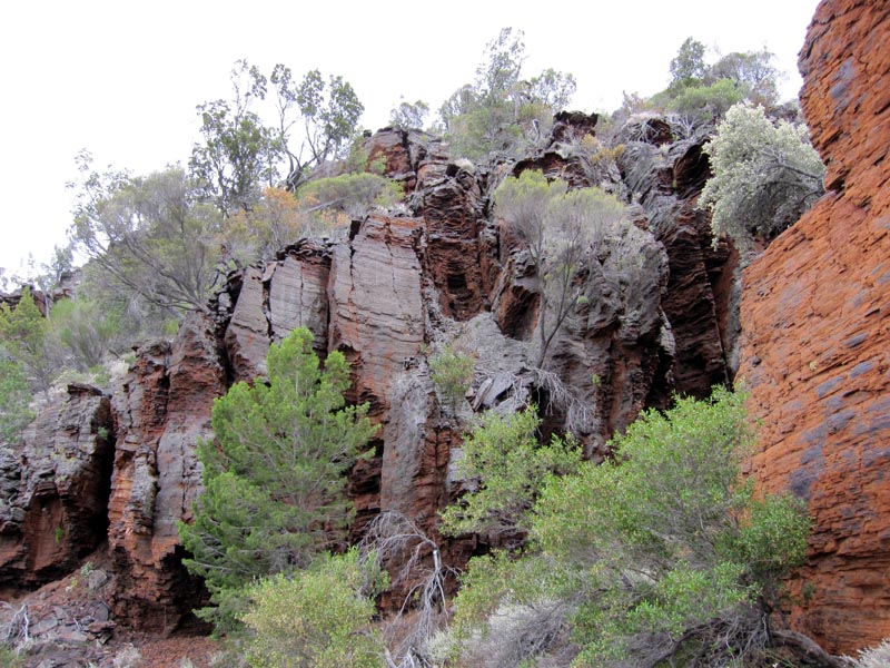
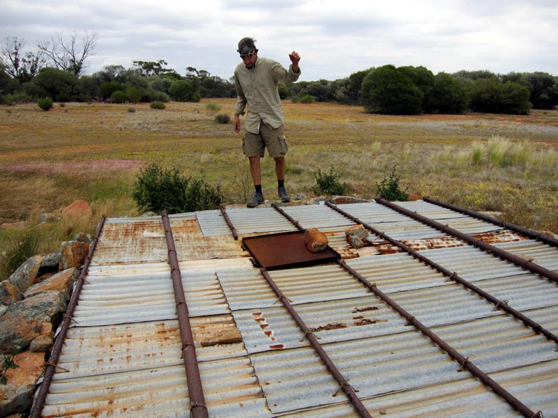
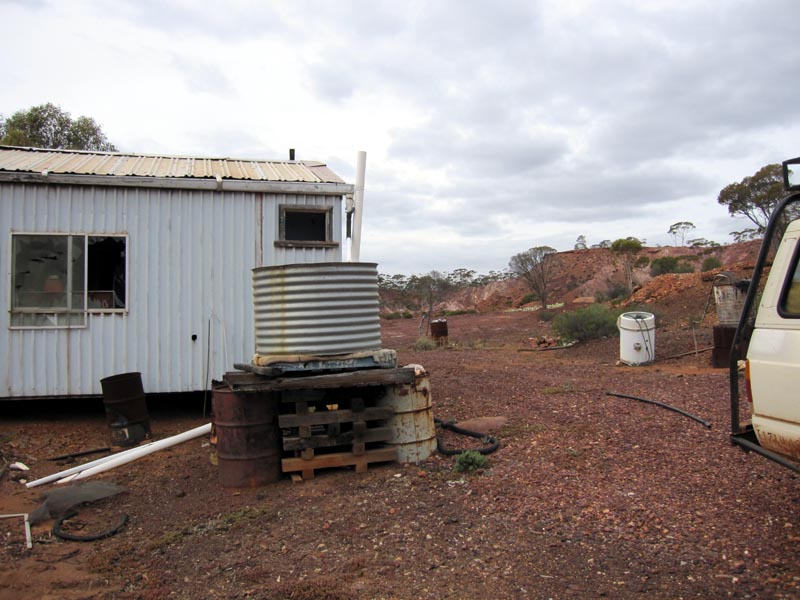
We continued heading south with the aim to come out on the transline access road. We reached the Breakaway Mining Center and decided to drive in and give it a look over. Abandoned somewhat recently, but both tanks (another is on the back side of the building) contain a full supply of rainwater captured from the roof and redirected by the gutters. In the picture, just behind the nissan is a hot water system, basically a heat exchanger sitting over a fire.
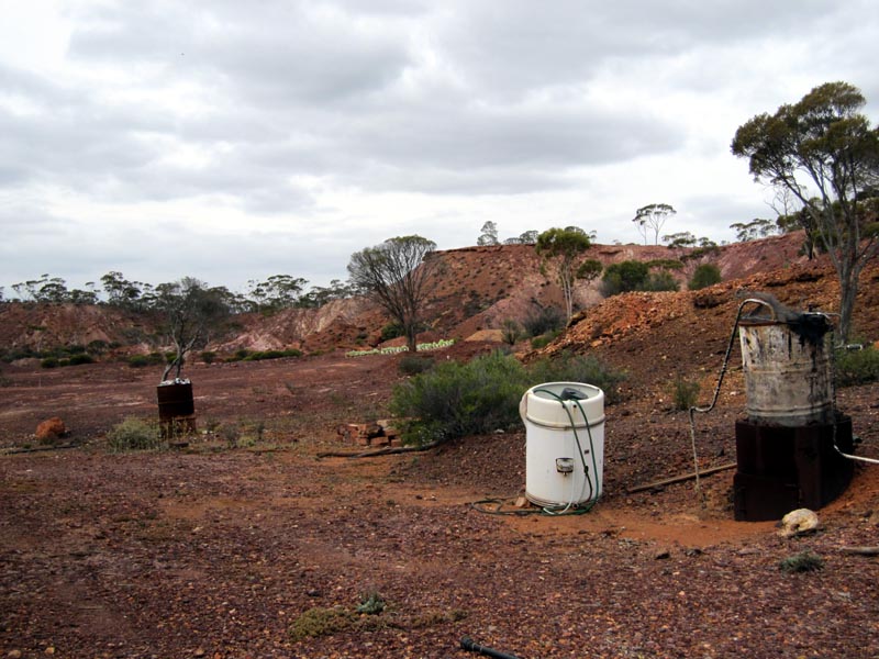
Better picture of the hot water system and also the breakaways (the namesake for this mining location) in the background.
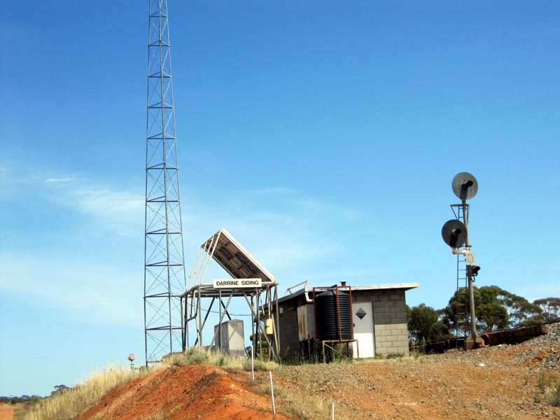
We camped a night south of the transline and Jaurdi, then the next day headed west along the transline access road. Here's a picture of Darrine Siding and a nice full rainwater tank of water. We filled up a gallon of water here Finally a day of mostly blue skies, something we didn't get to see much of on this entire trip.
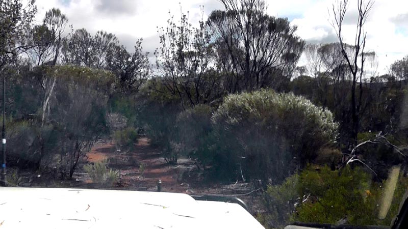
We turned off the transline access road to head south around the eastern edge of Lake Seabrook. This is a picture looking west across Lake Seabrook with Koolyanobbing Range in the background.
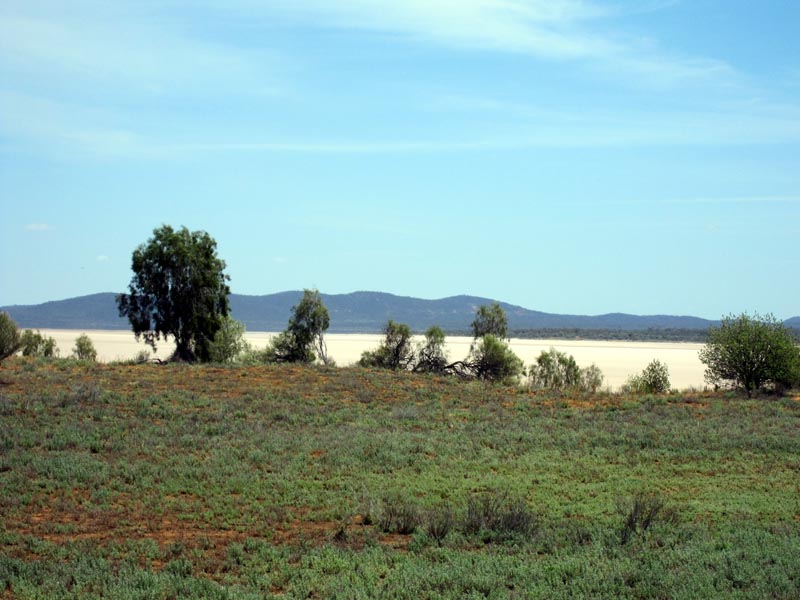
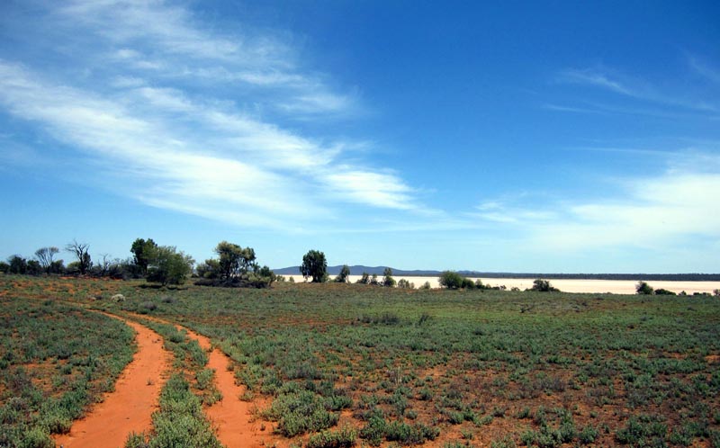
Along the edge of the lake the going is easy since there's very little scrub/vegetation. Unfortunately the track south from the lake was quite overgrown and we were pushing through dense scrub for quite a few k's. The track is definitely getting worse year after year, obviously it isn't used nearly as much as 10+ years ago when sandalwood cutting was likely still going on.
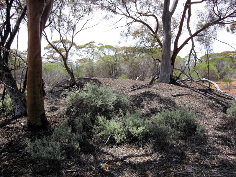
Heading south of Lake Seabrook we came across a few of these wood chip mounds. These are the remains from sandalwood cutters and we also found a few old axe heads laying around.
Screen grab of our tracklog heading south from Lake Seabrook. The northern part of the track is quite overgrown and the barwork on the nissan certainly help deflect a lot of branches from taking out the A-pillars.
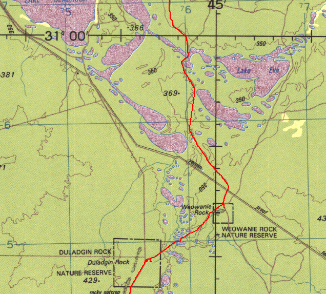
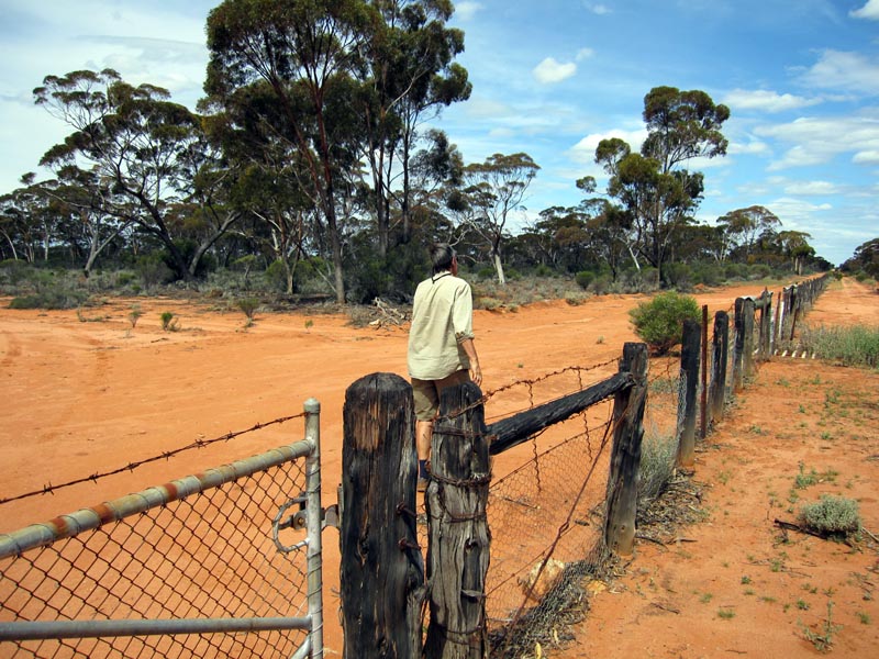
Continuing further south towards Weowanie Rock we cross a vermin proof fence. It was quite hilarious to see a hole under the fence and fresh rabbit scrapings and droppings on both sides... Though the fence seems to be doing a good job of keeping David on the north side.
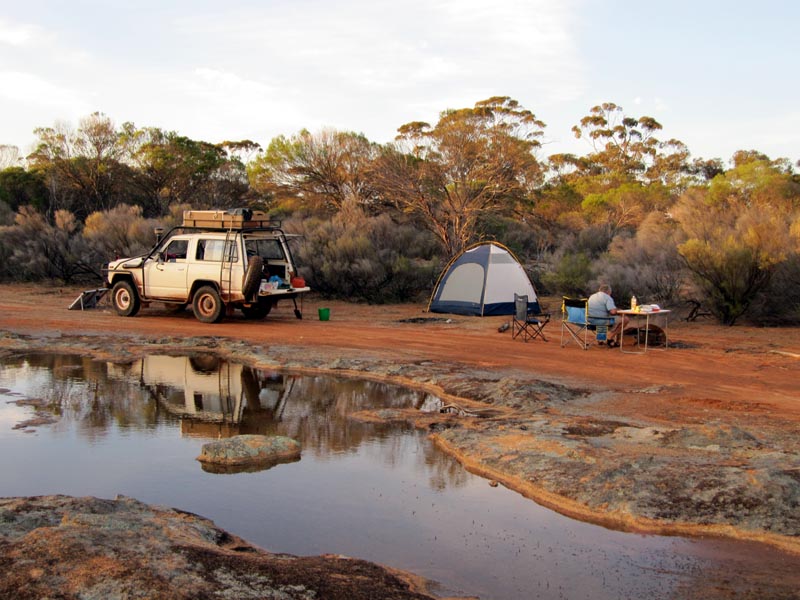
Camped at Weowanie Rocks and again considerable water all around us. The solar panel is setup facing the setting sun. The 80W panel did an excellent job of keeping the aux battery topped up during the entire trip. This allowed the Engel fridge to run 24/7 to keep our food and drinks cold.
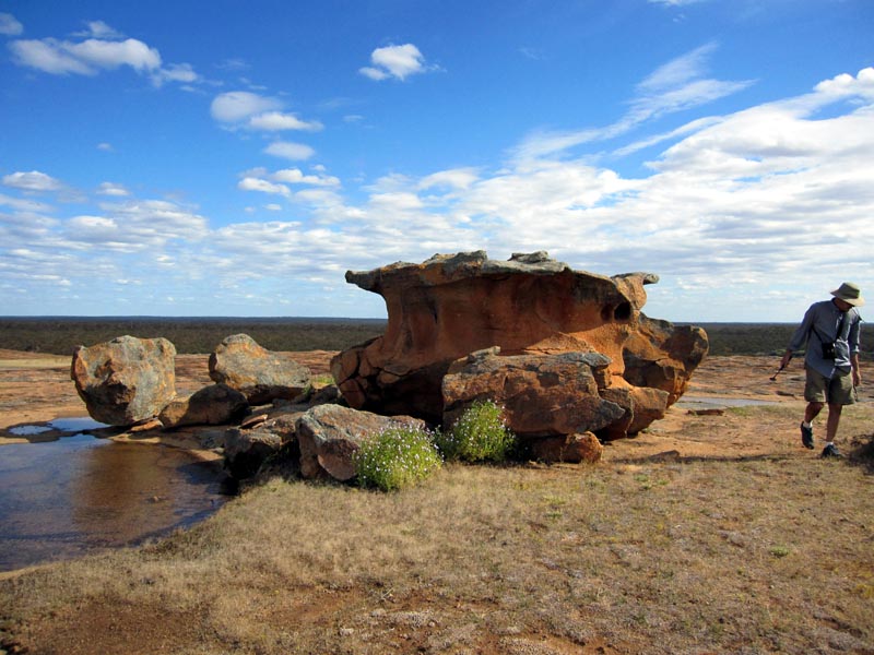
Exploring Weowanie Rock and finding more water.
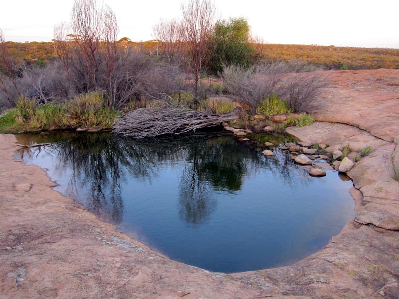
A nice Gnamma hole at least 4' deep at Weowanie Rock.
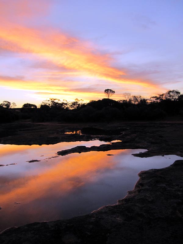
Our last night camping out and we're greeted with a rather spectacular sunset.
The next day we drove down to Duladgin Rock and then onto the main graded road down to Yellowdine. From there we headed back to Perth on the Great Eastern Highway.
![]()